La Capilla geodata
La Capilla (Zacatecas) is a populated place; located in Mexico in America/Mexico_City (GMT-6) time zone. With population of 1,552 people, there are 5556 cities with bigger population in this country. Compared to other cities in Mexico, 87.3% of cities are located further ↓South; 82.3% of cities are located further →East and 80.1% of cities have lower elevation than La Capilla. Note1


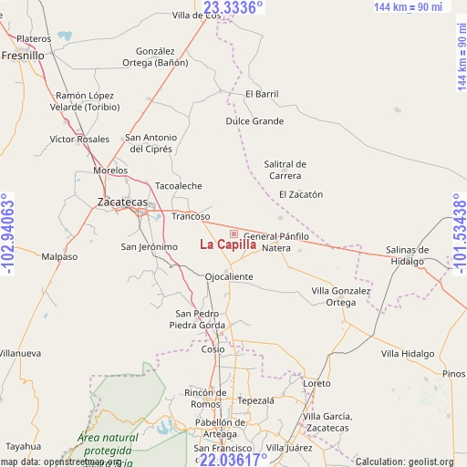
La Capilla GPS coordinates[2]
22° 41' 11.112" North, 102° 14' 15" West
| Map corner | latitude | longitude |
|---|---|---|
| Upper-left | 23.3336°, | -102.94063° |
| Center: | 22.68642°, | -102.2375° |
| Lower-right: | 22.03617°, | -101.53438° |
| Map W x H: | 144.3×144.3 km | = 89.7×89.7mi |
| max Lat: | 32.7° ⇑12.7% North |
| La Capilla: | 22.68642° |
| min Lat: | ⇓87.3% South 14.53588° |
| min Long | La Capilla | max Long |
| -117.105° | -102.2375° | -86.73105° |
| W 17.7%⇐ | ⇒82.3% E |
Elevation
Elevation of La Capilla is 2144 m = 7034 ft, and this is 890.3 m = 2921 ft above average elevation for this country.
| Max E: |
3497 m = 11473 ft | 19.9% |
| La Capilla | 2144 m 7034 ft | |
| Avg. | 1253.7 m = 4113 ft | |
Min E: |
-1 m = -3 ft | 80.1% |
See also: Mexico elevation on elevation.city.
Geographical zone
La Capilla is located in North Torrid zone (between Equator and Tropic of Cancer). Distance of this Northern Tropic circle is 83.4 km =51.8 mi to North.| Distance of | km | miles | from La Capilla |
|---|---|---|---|
| North Pole | 7484.6 | 4650.7 | to North |
| Arctic Circle | 4878.7 | 3031.5 | to North |
| Tropic Cancer | 83.4 | 51.8 | to North |
| Equator | 2522.5 | 1567.4 | to South |


Nearby cities:
15 places around La Capilla: (largest is in red/bold)
• Cerrito de la Cruz
4.8 km =3 mi,  228°
228°
• El Nuevo Mundo
6.3 km =3.9 mi,  32°
32°
• El Porvenir
14.8 km =9.2 mi,  4°
4°
• El Refugio
12.1 km =7.5 mi, 228°
• General Pánfilo Natera
13.3 km =8.3 mi,  100°
100°
• Guanajuatillo
10.2 km =6.3 mi,  70°
70°
• La Tesorera
12.4 km =7.7 mi,  84°
84°
• Noria del Cerro de Santiago (El Cerro)
15.4 km =9.6 mi,  56°
56°
• Palmillas
12.4 km =7.7 mi,  250°
250°
• Pozo de Jarillas
5.5 km =3.4 mi,  132°
132°
• Rancho Nuevo
15 km =9.3 mi,  124°
124°
• San Cristóbal
10.6 km =6.6 mi,  178°
178°
• San José del Carmen
9.7 km =6 mi,  336°
336°
• San Ramón
11.7 km =7.3 mi, 116°
• Trancoso
14.4 km =8.9 mi,  292°
292°
Sources, notices
• [Note1] Compared only with cities in Mexico existing in our database
• [Src1] Map data: © OpenStreetMap contributors (CC-BY-SA)
• [Src2] Other city data from geonames.org with taken over terms of usage.
• [Src3] Geographical zone / Annual Mean Temperature by Robert A. Rohde @ Wikipedia
