San Cristóbal geodata
San Cristóbal (Zacatecas) is a populated place; located in Mexico in America/Mexico_City (GMT-6) time zone. With population of 1,525 people, there are 5661 cities with bigger population in this country. Compared to other cities in Mexico, 87% of cities are located further ↓South; 82.2% of cities are located further →East and 77.2% of cities have lower elevation than San Cristóbal. Note1


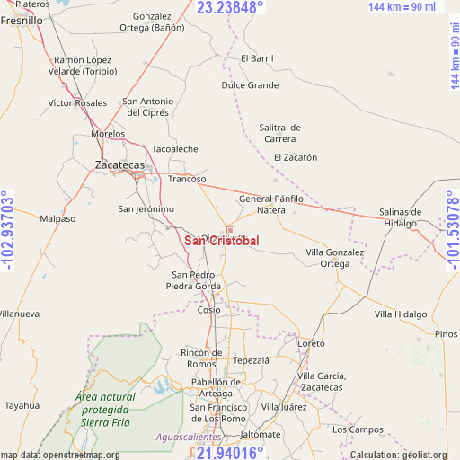
San Cristóbal GPS coordinates[2]
22° 35' 27.06" North, 102° 14' 2.04" West
| Map corner | latitude | longitude |
|---|---|---|
| Upper-left | 23.23848°, | -102.93703° |
| Center: | 22.59085°, | -102.2339° |
| Lower-right: | 21.94016°, | -101.53078° |
| Map W x H: | 144.4×144.4 km | = 89.7×89.7mi |
| max Lat: | 32.7° ⇑13% North |
| San Cristóbal: | 22.59085° |
| min Lat: | ⇓87% South 14.53588° |
| min Long | San Cristóbal | max Long |
| -117.105° | -102.2339° | -86.73105° |
| W 17.8%⇐ | ⇒82.2% E |
Elevation
Elevation of San Cristóbal is 2073 m = 6801 ft, and this is 819.3 m = 2688 ft above average elevation for this country.
| Max E: |
3497 m = 11473 ft | 22.8% |
| San Cristóbal | 2073 m 6801 ft | |
| Avg. | 1253.7 m = 4113 ft | |
Min E: |
-1 m = -3 ft | 77.2% |
See also: Mexico elevation on elevation.city.
Geographical zone
San Cristóbal is located in North Torrid zone (between Equator and Tropic of Cancer). Distance of this Northern Tropic circle is 94.1 km =58.5 mi to North.| Distance of | km | miles | from San Cristóbal |
|---|---|---|---|
| North Pole | 7495.2 | 4657.3 | to North |
| Arctic Circle | 4889.3 | 3038.1 | to North |
| Tropic Cancer | 94.1 | 58.5 | to North |
| Equator | 2511.9 | 1560.8 | to South |


Nearby cities:
15 places around San Cristóbal: (largest is in red/bold)
• Cerrito de la Cruz
8.4 km =5.2 mi,  331°
331°
• Colonia Hidalgo
9.3 km =5.8 mi,  182°
182°
• Colonia Veinte de Noviembre
11 km =6.8 mi,  206°
206°
• El Refugio
9.9 km =6.2 mi,  285°
285°
• Jarillas
5.8 km =3.6 mi,  142°
142°
• La Capilla
10.6 km =6.6 mi,  358°
358°
• La Concepción
9 km =5.6 mi,  201°
201°
• Milagros
11.4 km =7.1 mi,  152°
152°
• Palmillas
13.8 km =8.6 mi,  298°
298°
• Piedra Gorda
13.7 km =8.5 mi,  227°
227°
• Pozo de Jarillas
7.8 km =4.8 mi,  28°
28°
• Rancho Nuevo
12.2 km =7.6 mi,  80°
80°
• San Pablo
14.2 km =8.8 mi,  104°
104°
• San Ramón
11.5 km =7.1 mi,  61°
61°
• Tlacotes
10.4 km =6.5 mi,  259°
259°
Sources, notices
• [Note1] Compared only with cities in Mexico existing in our database
• [Src1] Map data: © OpenStreetMap contributors (CC-BY-SA)
• [Src2] Other city data from geonames.org with taken over terms of usage.
• [Src3] Geographical zone / Annual Mean Temperature by Robert A. Rohde @ Wikipedia
