Villa Victoria geodata
Villa Victoria (Michoacán) is a populated place; located in Mexico in America/Mexico_City (GMT-6) time zone. With population of 1,010 people, there are 8622 cities with bigger population in this country. Compared to other cities in Mexico, 69.4% of cities are located further ↑North; 87.6% of cities are located further →East and 64.9% of cities have higher elevation than Villa Victoria. Note1


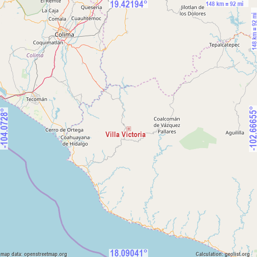
Villa Victoria GPS coordinates[2]
18° 45' 26.964" North, 103° 22' 10.812" West
| Map corner | latitude | longitude |
|---|---|---|
| Upper-left | 19.42194°, | -104.0728° |
| Center: | 18.75749°, | -103.36967° |
| Lower-right: | 18.09041°, | -102.66655° |
| Map W x H: | 148.1×148.1 km | = 92×92mi |
| max Lat: | 32.7° ⇑69.4% North |
| Villa Victoria: | 18.75749° |
| min Lat: | ⇓30.6% South 14.53588° |
| min Long | Villa Victoria | max Long |
| -117.105° | -103.36967° | -86.73105° |
| W 12.4%⇐ | ⇒87.6% E |
Elevation
Elevation of Villa Victoria is 691 m = 2267 ft, and this is 562.7 m = 1846 ft below average elevation for this country.
| Max E: |
3497 m = 11473 ft | 64.9% |
| Avg. | 1253.7 m = 4113 ft | |
| Villa Victoria | 691 m = 2267 ft | |
Min E: |
-1 m = -3 ft | 35.1% |
See also: Mexico elevation on elevation.city.
Geographical zone
Villa Victoria is located in North Torrid zone (between Equator and Tropic of Cancer). Distance of this Northern Tropic circle is 520.3 km =323.3 mi to North.| Distance of | km | miles | from Villa Victoria |
|---|---|---|---|
| North Pole | 7921.4 | 4922.1 | to North |
| Arctic Circle | 5315.5 | 3302.9 | to North |
| Tropic Cancer | 520.3 | 323.3 | to North |
| Equator | 2085.6 | 1295.9 | to South |


Nearby cities:
15 places around Villa Victoria: (largest is in red/bold)
• Aquila
22.6 km =14 mi,  218°
218°
• Cerro de Ortega
37.1 km =23.1 mi,  268°
268°
• Coahuayana Viejo
31.4 km =19.5 mi, 268°
• Coahuayana de Hidalgo
31.3 km =19.4 mi,  258°
258°
• Coalcomán de Vázquez Pallares
22.2 km =13.8 mi,  84°
84°
• Cofradía de Morelos
50.7 km =31.5 mi,  284°
284°
• Colola
51.4 km =31.9 mi,  184°
184°
• Colonia Veinte de Noviembre (El Camalote)
27.6 km =17.1 mi, 272°
• Dos Aguas
47 km =29.2 mi, 83°
• Ixtlahuacán
47.1 km =29.3 mi,  305°
305°
• La Placita de Morelos
34 km =21.1 mi, 222°
• La Ticla
38.9 km =24.2 mi,  210°
210°
• Los Tepames
45.9 km =28.5 mi,  324°
324°
• Santa María de Ostula
30.5 km =19 mi,  201°
201°
• Zapotán
24.7 km =15.3 mi, 257°
Sources, notices
• [Note1] Compared only with cities in Mexico existing in our database
• [Src1] Map data: © OpenStreetMap contributors (CC-BY-SA)
• [Src2] Other city data from geonames.org with taken over terms of usage.
• [Src3] Geographical zone / Annual Mean Temperature by Robert A. Rohde @ Wikipedia
