Los Tepames geodata
Los Tepames (Colima) is a populated place; located in Mexico in America/Mexico_City (GMT-6) time zone. With population of 1,655 people, there are 5245 cities with bigger population in this country. Compared to other cities in Mexico, 63.2% of cities are located further ↑North; 88.8% of cities are located further →East and 68.9% of cities have higher elevation than Los Tepames. Note1


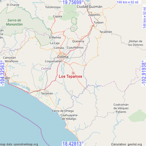
Los Tepames GPS coordinates[2]
19° 5' 38.004" North, 103° 37' 21" West
| Map corner | latitude | longitude |
|---|---|---|
| Upper-left | 19.75699°, | -104.32563° |
| Center: | 19.09389°, | -103.6225° |
| Lower-right: | 18.42813°, | -102.91938° |
| Map W x H: | 147.8×147.8 km | = 91.8×91.8mi |
| max Lat: | 32.7° ⇑63.2% North |
| Los Tepames: | 19.09389° |
| min Lat: | ⇓36.8% South 14.53588° |
| min Long | Los Tepames | max Long |
| -117.105° | -103.6225° | -86.73105° |
| W 11.2%⇐ | ⇒88.8% E |
Elevation
Elevation of Los Tepames is 475 m = 1558 ft, and this is 778.7 m = 2555 ft below average elevation for this country.
| Max E: |
3497 m = 11473 ft | 68.9% |
| Avg. | 1253.7 m = 4113 ft | |
| Los Tepames | 475 m = 1558 ft | |
Min E: |
-1 m = -3 ft | 31.1% |
See also: Mexico elevation on elevation.city.
Geographical zone
Los Tepames is located in North Torrid zone (between Equator and Tropic of Cancer). Distance of this Northern Tropic circle is 482.9 km =300.1 mi to North.| Distance of | km | miles | from Los Tepames |
|---|---|---|---|
| North Pole | 7884 | 4898.9 | to North |
| Arctic Circle | 5278.1 | 3279.7 | to North |
| Tropic Cancer | 482.9 | 300.1 | to North |
| Equator | 2123 | 1319.2 | to South |


Nearby cities:
15 places around Los Tepames: (largest is in red/bold)
• Alzada
20.7 km =12.9 mi,  28°
28°
• Buenavista
17.4 km =10.8 mi,  3°
3°
• Ciudad de Villa de Álvarez
22.8 km =14.2 mi,  327°
327°
• Colima
20.5 km =12.7 mi, 327°
• Coquimatlán
23.3 km =14.5 mi,  302°
302°
• Cuauhtémoc
26.2 km =16.3 mi, 4°
• El Chanal
24 km =14.9 mi,  338°
338°
• El Trapiche
20.9 km =13 mi,  348°
348°
• Ixtlahuacán
15.8 km =9.8 mi,  229°
229°
• La Estrella
22.1 km =13.7 mi,  50°
50°
• Las Guásimas (Las Borregas)
11.1 km =6.9 mi,  283°
283°
• Los Asmoles
16.1 km =10 mi, 280°
• Madrid
26.2 km =16.3 mi,  267°
267°
• Piscila
11 km =6.8 mi,  311°
311°
• Tecolapa
23.4 km =14.5 mi,  249°
249°
Sources, notices
• [Note1] Compared only with cities in Mexico existing in our database
• [Src1] Map data: © OpenStreetMap contributors (CC-BY-SA)
• [Src2] Other city data from geonames.org with taken over terms of usage.
• [Src3] Geographical zone / Annual Mean Temperature by Robert A. Rohde @ Wikipedia
