Villa Ocampo geodata
Villa Ocampo (Durango) is a seat of a second-order administrative division; located in Mexico in America/Monterrey (GMT-6) time zone. With population of 1,076 people, there are 8105 cities with bigger population in this country. Compared to other cities in Mexico, 95.8% of cities are located further ↓South; 93.3% of cities are located further →East and 60.3% of cities have lower elevation than Villa Ocampo. Note1


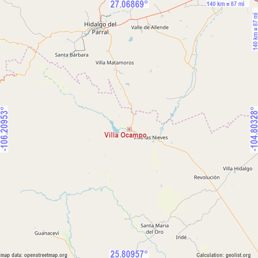
Villa Ocampo GPS coordinates[2]
26° 26' 27.06" North, 105° 30' 23.04" West
| Map corner | latitude | longitude |
|---|---|---|
| Upper-left | 27.06869°, | -106.20953° |
| Center: | 26.44085°, | -105.5064° |
| Lower-right: | 25.80957°, | -104.80328° |
| Map W x H: | 140×140 km | = 87×87mi |
| max Lat: | 32.7° ⇑4.2% North |
| Villa Ocampo: | 26.44085° |
| min Lat: | ⇓95.8% South 14.53588° |
| min Long | Villa Ocampo | max Long |
| -117.105° | -105.5064° | -86.73105° |
| W 6.7%⇐ | ⇒93.3% E |
Elevation
Elevation of Villa Ocampo is 1730 m = 5676 ft, and this is 476.3 m = 1563 ft above average elevation for this country.
| Max E: |
3497 m = 11473 ft | 39.7% |
| Villa Ocampo | 1730 m 5676 ft | |
| Avg. | 1253.7 m = 4113 ft | |
Min E: |
-1 m = -3 ft | 60.3% |
See also: Mexico elevation on elevation.city.
Geographical zone
Villa Ocampo is located in North temperate zone (between Tropic of Cancer and the Arctic Circle). Distance of this Northern Tropic circle is 334 km =207.5 mi to South.| Distance of | km | miles | from Villa Ocampo |
|---|---|---|---|
| North Pole | 7067.1 | 4391.3 | to North |
| Arctic Circle | 4461.2 | 2772.1 | to North |
| Tropic Cancer | 334 | 207.5 | to South |
| Equator | 2939.9 | 1826.8 | to South |


Nearby cities:
15 places around Villa Ocampo: (largest is in red/bold)
• Canutillo
14.9 km =9.3 mi,  116°
116°
• Coronado
47.8 km =29.7 mi,  46°
46°
• El Oro
58 km =36 mi,  324°
324°
• José Esteban Coronado
47.8 km =29.7 mi, 46°
• Matamoros
36.6 km =22.7 mi,  347°
347°
• Parral
56.7 km =35.2 mi,  343°
343°
• Pueblito de Allende
63.7 km =39.6 mi,  16°
16°
• Revolución
49.8 km =30.9 mi, 121°
• San Bernardo
49 km =30.4 mi,  182°
182°
• Santa Bárbara
51 km =31.7 mi, 322°
• Santa María del Oro
56.4 km =35 mi,  165°
165°
• Talamantes
52.9 km =32.9 mi,  7°
7°
• Torreón de Cañas
24.4 km =15.2 mi,  107°
107°
• Valle de Allende
56.1 km =34.9 mi, 11°
• Villa Hidalgo
62.8 km =39 mi, 109°
Sources, notices
• [Note1] Compared only with cities in Mexico existing in our database
• [Src1] Map data: © OpenStreetMap contributors (CC-BY-SA)
• [Src2] Other city data from geonames.org with taken over terms of usage.
• [Src3] Geographical zone / Annual Mean Temperature by Robert A. Rohde @ Wikipedia
