Talamantes geodata
Talamantes (Chihuahua) is a populated place; located in Mexico in America/Chihuahua (GMT-6) time zone. With population of 512 people, there are 16417 cities with bigger population in this country. Compared to other cities in Mexico, 96.2% of cities are located further ↓South; 93.1% of cities are located further →East and 56.4% of cities have lower elevation than Talamantes. Note1


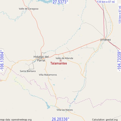
Talamantes GPS coordinates[2]
26° 54' 43.452" North, 105° 26' 12.156" West
| Map corner | latitude | longitude |
|---|---|---|
| Upper-left | 27.5373°, | -106.13984° |
| Center: | 26.91207°, | -105.43671° |
| Lower-right: | 26.28336°, | -104.73359° |
| Map W x H: | 139.4×139.4 km | = 86.6×86.6mi |
| max Lat: | 32.7° ⇑3.8% North |
| Talamantes: | 26.91207° |
| min Lat: | ⇓96.2% South 14.53588° |
| min Long | Talamantes | max Long |
| -117.105° | -105.43671° | -86.73105° |
| W 6.9%⇐ | ⇒93.1% E |
Elevation
Elevation of Talamantes is 1636 m = 5367 ft, and this is 382.3 m = 1254 ft above average elevation for this country.
| Max E: |
3497 m = 11473 ft | 43.6% |
| Talamantes | 1636 m 5367 ft | |
| Avg. | 1253.7 m = 4113 ft | |
Min E: |
-1 m = -3 ft | 56.4% |
See also: Mexico elevation on elevation.city.
Geographical zone
Talamantes is located in North temperate zone (between Tropic of Cancer and the Arctic Circle). Distance of this Northern Tropic circle is 386.4 km =240.1 mi to South.| Distance of | km | miles | from Talamantes |
|---|---|---|---|
| North Pole | 7014.7 | 4358.7 | to North |
| Arctic Circle | 4408.8 | 2739.5 | to North |
| Tropic Cancer | 386.4 | 240.1 | to South |
| Equator | 2992.3 | 1859.3 | to South |


Nearby cities:
15 places around Talamantes: (largest is in red/bold)
• Canutillo
59.5 km =37 mi,  173°
173°
• Coronado
33.6 km =20.9 mi,  125°
125°
• El Oro
41.2 km =25.6 mi,  262°
262°
• José Esteban Coronado
33.8 km =21 mi, 125°
• José Mariano Jiménez
56.3 km =35 mi,  64°
64°
• López
41.1 km =25.5 mi,  75°
75°
• Matamoros
22.3 km =13.9 mi,  221°
221°
• Octaviano López
41.2 km =25.6 mi, 75°
• Parral
22.9 km =14.2 mi,  275°
275°
• Pueblito de Allende
14 km =8.7 mi,  51°
51°
• Santa Bárbara
39.9 km =24.8 mi,  252°
252°
• Santa María
44 km =27.3 mi,  73°
73°
• Torreón de Cañas
62 km =38.5 mi,  164°
164°
• Valle de Allende
5.1 km =3.2 mi, 59°
• Villa Ocampo
52.9 km =32.9 mi,  187°
187°
Sources, notices
• [Note1] Compared only with cities in Mexico existing in our database
• [Src1] Map data: © OpenStreetMap contributors (CC-BY-SA)
• [Src2] Other city data from geonames.org with taken over terms of usage.
• [Src3] Geographical zone / Annual Mean Temperature by Robert A. Rohde @ Wikipedia
