Valle de Allende geodata
Valle de Allende (Chihuahua) is a seat of a second-order administrative division; located in Mexico in America/Chihuahua (GMT-6) time zone. With population of 4,185 people, there are 2189 cities with bigger population in this country. Compared to other cities in Mexico, 96.2% of cities are located further ↓South; 93% of cities are located further →East and 55.6% of cities have lower elevation than Valle de Allende. Note1


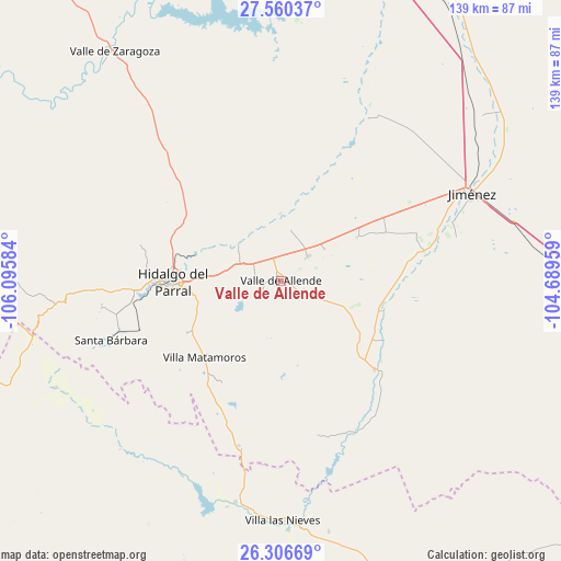
Valle de Allende GPS coordinates[2]
26° 56' 6.972" North, 105° 23' 33.756" West
| Map corner | latitude | longitude |
|---|---|---|
| Upper-left | 27.56037°, | -106.09584° |
| Center: | 26.93527°, | -105.39271° |
| Lower-right: | 26.30669°, | -104.68959° |
| Map W x H: | 139.4×139.4 km | = 86.6×86.6mi |
| max Lat: | 32.7° ⇑3.8% North |
| Valle de Allende: | 26.93527° |
| min Lat: | ⇓96.2% South 14.53588° |
| min Long | Valle de Allend | max Long |
| -117.105° | -105.39271° | -86.73105° |
| W 7%⇐ | ⇒93% E |
Elevation
Elevation of Valle de Allende is 1604 m = 5262 ft, and this is 350.3 m = 1149 ft above average elevation for this country.
| Max E: |
3497 m = 11473 ft | 44.4% |
| Valle de Allende | 1604 m 5262 ft | |
| Avg. | 1253.7 m = 4113 ft | |
Min E: |
-1 m = -3 ft | 55.6% |
See also: Mexico elevation on elevation.city.
Geographical zone
Valle de Allende is located in North temperate zone (between Tropic of Cancer and the Arctic Circle). Distance of this Northern Tropic circle is 389 km =241.7 mi to South.| Distance of | km | miles | from Valle de Allende |
|---|---|---|---|
| North Pole | 7012.1 | 4357.1 | to North |
| Arctic Circle | 4406.3 | 2737.9 | to North |
| Tropic Cancer | 389 | 241.7 | to South |
| Equator | 2994.9 | 1860.9 | to South |


Nearby cities:
15 places around Valle de Allende: (largest is in red/bold)
• Canutillo
61.8 km =38.4 mi,  178°
178°
• Coronado
31.9 km =19.8 mi,  133°
133°
• El Oro
45.9 km =28.5 mi,  259°
259°
• José Esteban Coronado
32 km =19.9 mi, 133°
• José Mariano Jiménez
51.3 km =31.9 mi,  64°
64°
• López
36.3 km =22.6 mi,  78°
78°
• Matamoros
27.1 km =16.8 mi,  224°
224°
• Octaviano López
36.4 km =22.6 mi, 78°
• Parral
27.1 km =16.8 mi,  268°
268°
• Pueblito de Allende
9 km =5.6 mi,  46°
46°
• Santa Bárbara
44.9 km =27.9 mi,  250°
250°
• Santa María
39.1 km =24.3 mi, 75°
• Talamantes
5.1 km =3.2 mi,  239°
239°
• Torreón de Cañas
63.5 km =39.5 mi,  169°
169°
• Villa Ocampo
56.1 km =34.9 mi,  191°
191°
Sources, notices
• [Note1] Compared only with cities in Mexico existing in our database
• [Src1] Map data: © OpenStreetMap contributors (CC-BY-SA)
• [Src2] Other city data from geonames.org with taken over terms of usage.
• [Src3] Geographical zone / Annual Mean Temperature by Robert A. Rohde @ Wikipedia
