Villa Corona geodata
Villa Corona (Jalisco) is a seat of a second-order administrative division; located in Mexico in America/Mexico_City (GMT-6) time zone. With population of 7,603 people, there are 1222 cities with bigger population in this country. Compared to other cities in Mexico, 66% of cities are located further ↓South; 88.9% of cities are located further →East and 51.5% of cities have higher elevation than Villa Corona. Note1


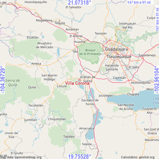
Villa Corona GPS coordinates[2]
20° 24' 56.304" North, 103° 39' 50.976" West
| Map corner | latitude | longitude |
|---|---|---|
| Upper-left | 21.07318°, | -104.36729° |
| Center: | 20.41564°, | -103.66416° |
| Lower-right: | 19.75528°, | -102.96104° |
| Map W x H: | 146.5×146.5 km | = 91×91mi |
| max Lat: | 32.7° ⇑34% North |
| Villa Corona: | 20.41564° |
| min Lat: | ⇓66% South 14.53588° |
| min Long | Villa Corona | max Long |
| -117.105° | -103.66416° | -86.73105° |
| W 11.1%⇐ | ⇒88.9% E |
Elevation
Elevation of Villa Corona is 1359 m = 4459 ft, and this is 105.3 m = 345 ft above average elevation for this country.
| Max E: |
3497 m = 11473 ft | 51.5% |
| Villa Corona | 1359 m 4459 ft | |
| Avg. | 1253.7 m = 4113 ft | |
Min E: |
-1 m = -3 ft | 48.5% |
See also: Mexico elevation on elevation.city.
Geographical zone
Villa Corona is located in North Torrid zone (between Equator and Tropic of Cancer). Distance of this Northern Tropic circle is 335.9 km =208.7 mi to North.| Distance of | km | miles | from Villa Corona |
|---|---|---|---|
| North Pole | 7737.1 | 4807.6 | to North |
| Arctic Circle | 5131.2 | 3188.4 | to North |
| Tropic Cancer | 335.9 | 208.7 | to North |
| Equator | 2270 | 1410.5 | to South |


Nearby cities:
15 places around Villa Corona: (largest is in red/bold)
• Acatlán de Juárez
7.7 km =4.8 mi,  84°
84°
• Atotonilco el Bajo
7.2 km =4.5 mi,  188°
188°
• Bellavista
3.5 km =2.2 mi,  53°
53°
• Buenavista
12.5 km =7.8 mi,  225°
225°
• Cofradia
12.8 km =8 mi,  59°
59°
• Cruz Vieja
12.9 km =8 mi, 46°
• El Molino
13.7 km =8.5 mi,  102°
102°
• El Plan
6 km =3.7 mi,  87°
87°
• Estipa
8.6 km =5.3 mi, 226°
• General Andrés Figueroa
13.7 km =8.5 mi,  155°
155°
• Juan Gil Preciado
8.1 km =5 mi, 234°
• Navajas
13.2 km =8.2 mi,  352°
352°
• San Isidro Mazatepec
13.1 km =8.1 mi,  24°
24°
• San José de los Pozos
12.2 km =7.6 mi,  126°
126°
• Villa de los Niños
12.8 km =8 mi, 94°
Sources, notices
• [Note1] Compared only with cities in Mexico existing in our database
• [Src1] Map data: © OpenStreetMap contributors (CC-BY-SA)
• [Src2] Other city data from geonames.org with taken over terms of usage.
• [Src3] Geographical zone / Annual Mean Temperature by Robert A. Rohde @ Wikipedia
