Bellavista geodata
Bellavista (Jalisco) is a populated place; located in Mexico in America/Mexico_City (GMT-6) time zone. With population of 7,163 people, there are 1297 cities with bigger population in this country. Compared to other cities in Mexico, 66.4% of cities are located further ↓South; 88.8% of cities are located further →East and 50.5% of cities have higher elevation than Bellavista. Note1


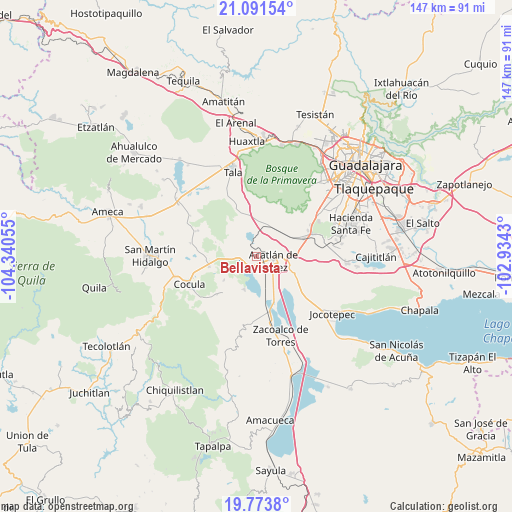
Bellavista GPS coordinates[2]
20° 26' 2.688" North, 103° 38' 14.712" West
| Map corner | latitude | longitude |
|---|---|---|
| Upper-left | 21.09154°, | -104.34055° |
| Center: | 20.43408°, | -103.63742° |
| Lower-right: | 19.7738°, | -102.9343° |
| Map W x H: | 146.5×146.5 km | = 91×91mi |
| max Lat: | 32.7° ⇑33.6% North |
| Bellavista: | 20.43408° |
| min Lat: | ⇓66.4% South 14.53588° |
| min Long | Bellavista | max Long |
| -117.105° | -103.63742° | -86.73105° |
| W 11.2%⇐ | ⇒88.8% E |
Elevation
Elevation of Bellavista is 1404 m = 4606 ft, and this is 150.3 m = 493 ft above average elevation for this country.
| Max E: |
3497 m = 11473 ft | 50.5% |
| Bellavista | 1404 m 4606 ft | |
| Avg. | 1253.7 m = 4113 ft | |
Min E: |
-1 m = -3 ft | 49.5% |
See also: Mexico elevation on elevation.city.
Geographical zone
Bellavista is located in North Torrid zone (between Equator and Tropic of Cancer). Distance of this Northern Tropic circle is 333.9 km =207.5 mi to North.| Distance of | km | miles | from Bellavista |
|---|---|---|---|
| North Pole | 7735 | 4806.3 | to North |
| Arctic Circle | 5129.1 | 3187.1 | to North |
| Tropic Cancer | 333.9 | 207.5 | to North |
| Equator | 2272.1 | 1411.8 | to South |


Nearby cities:
15 places around Bellavista: (largest is in red/bold)
• Acatlán de Juárez
5.1 km =3.2 mi,  104°
104°
• Atotonilco el Bajo
10 km =6.2 mi,  202°
202°
• Cofradia
9.3 km =5.8 mi,  62°
62°
• Cruz Vieja
9.5 km =5.9 mi,  44°
44°
• El Molino
11.8 km =7.3 mi,  115°
115°
• El Plan
3.6 km =2.2 mi, 118°
• Estipa
12 km =7.5 mi,  228°
228°
• Juan Gil Preciado
11.6 km =7.2 mi, 233°
• La Villita
12 km =7.5 mi,  7°
7°
• Navajas
11.9 km =7.4 mi,  338°
338°
• San Isidro Mazatepec
10.2 km =6.3 mi, 14°
• San José de los Pozos
11.7 km =7.3 mi,  143°
143°
• Santa Cruz de la Loma (Tepetates)
10.9 km =6.8 mi, 56°
• Villa Corona
3.5 km =2.2 mi, 233°
• Villa de los Niños
10.4 km =6.5 mi,  106°
106°
Sources, notices
• [Note1] Compared only with cities in Mexico existing in our database
• [Src1] Map data: © OpenStreetMap contributors (CC-BY-SA)
• [Src2] Other city data from geonames.org with taken over terms of usage.
• [Src3] Geographical zone / Annual Mean Temperature by Robert A. Rohde @ Wikipedia
