Veinte de Noviembre geodata
Veinte de Noviembre (Michoacán) is a populated place; located in Mexico in America/Mexico_City (GMT-6) time zone. With population of 699 people, there are 12460 cities with bigger population in this country. Compared to other cities in Mexico, 63.5% of cities are located further ↑North; 82.4% of cities are located further →East and 70.4% of cities have higher elevation than Veinte de Noviembre. Note1


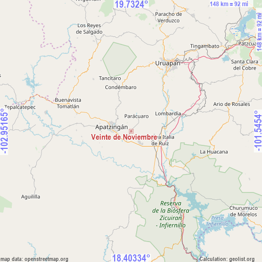
Veinte de Noviembre GPS coordinates[2]
19° 4' 9.12" North, 102° 14' 54.672" West
| Map corner | latitude | longitude |
|---|---|---|
| Upper-left | 19.7324°, | -102.95165° |
| Center: | 19.0692°, | -102.24852° |
| Lower-right: | 18.40334°, | -101.5454° |
| Map W x H: | 147.8×147.8 km | = 91.8×91.8mi |
| max Lat: | 32.7° ⇑63.5% North |
| Veinte de Noviembre: | 19.0692° |
| min Lat: | ⇓36.5% South 14.53588° |
| min Long | Veinte de Novie | max Long |
| -117.105° | -102.24852° | -86.73105° |
| W 17.6%⇐ | ⇒82.4% E |
Elevation
Elevation of Veinte de Noviembre is 400 m = 1312 ft, and this is 853.7 m = 2801 ft below average elevation for this country.
| Max E: |
3497 m = 11473 ft | 70.4% |
| Avg. | 1253.7 m = 4113 ft | |
| Veinte de Noviembre | 400 m = 1312 ft | |
Min E: |
-1 m = -3 ft | 29.6% |
See also: Mexico elevation on elevation.city.
Geographical zone
Veinte de Noviembre is located in North Torrid zone (between Equator and Tropic of Cancer). Distance of this Northern Tropic circle is 485.6 km =301.7 mi to North.| Distance of | km | miles | from Veinte de Noviembre |
|---|---|---|---|
| North Pole | 7886.8 | 4900.6 | to North |
| Arctic Circle | 5280.9 | 3281.4 | to North |
| Tropic Cancer | 485.6 | 301.7 | to North |
| Equator | 2120.3 | 1317.5 | to South |


Nearby cities:
15 places around Veinte de Noviembre: (largest is in red/bold)
• Antúnez
7.7 km =4.8 mi,  142°
142°
• Antúnez (Morelos)
7.8 km =4.8 mi, 143°
• Apatzingán
11.6 km =7.2 mi,  280°
280°
• Buenos Aires
7.2 km =4.5 mi,  84°
84°
• Cancita
14.7 km =9.1 mi,  199°
199°
• Chiquihuitillo
12.1 km =7.5 mi,  236°
236°
• El Caulote
13.7 km =8.5 mi,  63°
63°
• El Ceñidor
9.6 km =6 mi, 140°
• Fraccionamiento Girasoles
7.5 km =4.7 mi,  254°
254°
• La Huerta
5.3 km =3.3 mi,  309°
309°
• Los Bancos
13.4 km =8.3 mi,  18°
18°
• Paracuaro
9.4 km =5.8 mi, 19°
• Presa del Rosario
16.9 km =10.5 mi,  269°
269°
• San Antonio la Labor
7 km =4.3 mi,  231°
231°
• Uspero
6.5 km =4 mi, 199°
Sources, notices
• [Note1] Compared only with cities in Mexico existing in our database
• [Src1] Map data: © OpenStreetMap contributors (CC-BY-SA)
• [Src2] Other city data from geonames.org with taken over terms of usage.
• [Src3] Geographical zone / Annual Mean Temperature by Robert A. Rohde @ Wikipedia
