El Caulote geodata
El Caulote (Michoacán) is a populated place; located in Mexico in America/Mexico_City (GMT-6) time zone. With population of 651 people, there are 13306 cities with bigger population in this country. Compared to other cities in Mexico, 62.6% of cities are located further ↑North; 81.7% of cities are located further →East and 66% of cities have higher elevation than El Caulote. Note1


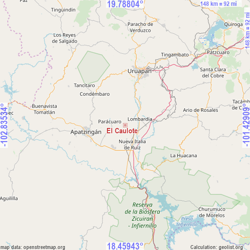
El Caulote GPS coordinates[2]
19° 7' 30.252" North, 102° 7' 55.956" West
| Map corner | latitude | longitude |
|---|---|---|
| Upper-left | 19.78804°, | -102.83534° |
| Center: | 19.12507°, | -102.13221° |
| Lower-right: | 18.45943°, | -101.42909° |
| Map W x H: | 147.7×147.7 km | = 91.8×91.8mi |
| max Lat: | 32.7° ⇑62.6% North |
| El Caulote: | 19.12507° |
| min Lat: | ⇓37.4% South 14.53588° |
| min Long | El Caulote | max Long |
| -117.105° | -102.13221° | -86.73105° |
| W 18.3%⇐ | ⇒81.7% E |
Elevation
Elevation of El Caulote is 635 m = 2083 ft, and this is 618.7 m = 2030 ft below average elevation for this country.
| Max E: |
3497 m = 11473 ft | 66% |
| Avg. | 1253.7 m = 4113 ft | |
| El Caulote | 635 m = 2083 ft | |
Min E: |
-1 m = -3 ft | 34% |
See also: Mexico elevation on elevation.city.
Geographical zone
El Caulote is located in North Torrid zone (between Equator and Tropic of Cancer). Distance of this Northern Tropic circle is 479.4 km =297.9 mi to North.| Distance of | km | miles | from El Caulote |
|---|---|---|---|
| North Pole | 7880.6 | 4896.8 | to North |
| Arctic Circle | 5274.7 | 3277.5 | to North |
| Tropic Cancer | 479.4 | 297.9 | to North |
| Equator | 2126.5 | 1321.3 | to South |


Nearby cities:
15 places around El Caulote: (largest is in red/bold)
• Antúnez
14.4 km =8.9 mi,  211°
211°
• Antúnez (Morelos)
14.6 km =9.1 mi, 211°
• Buenos Aires
7.5 km =4.7 mi,  222°
222°
• Charapendo
16.9 km =10.5 mi,  24°
24°
• Cuatro Caminos
15.5 km =9.6 mi,  168°
168°
• El Ceñidor
14.9 km =9.3 mi,  204°
204°
• El Guaco
10.1 km =6.3 mi,  129°
129°
• Estación Nueva Italia
8.1 km =5 mi,  143°
143°
• La Estancia
10.7 km =6.6 mi,  332°
332°
• La Huerta
16.6 km =10.3 mi,  260°
260°
• Lombardía
9.3 km =5.8 mi,  66°
66°
• Los Bancos
10.2 km =6.3 mi,  309°
309°
• Nueva Italia de Ruiz
11.9 km =7.4 mi,  159°
159°
• Paracuaro
9.5 km =5.9 mi,  286°
286°
• Veinte de Noviembre
13.7 km =8.5 mi,  243°
243°
Sources, notices
• [Note1] Compared only with cities in Mexico existing in our database
• [Src1] Map data: © OpenStreetMap contributors (CC-BY-SA)
• [Src2] Other city data from geonames.org with taken over terms of usage.
• [Src3] Geographical zone / Annual Mean Temperature by Robert A. Rohde @ Wikipedia
