Los Bancos geodata
Los Bancos (Michoacán) is a populated place; located in Mexico in America/Mexico_City (GMT-6) time zone. With population of 844 people, there are 10365 cities with bigger population in this country. Compared to other cities in Mexico, 61.6% of cities are located further ↑North; 82.1% of cities are located further →East and 63.7% of cities have higher elevation than Los Bancos. Note1


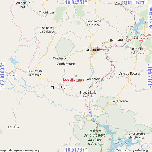
Los Bancos GPS coordinates[2]
19° 10' 58.008" North, 102° 12' 25.992" West
| Map corner | latitude | longitude |
|---|---|---|
| Upper-left | 19.84551°, | -102.91035° |
| Center: | 19.18278°, | -102.20722° |
| Lower-right: | 18.51737°, | -101.5041° |
| Map W x H: | 147.7×147.7 km | = 91.8×91.8mi |
| max Lat: | 32.7° ⇑61.6% North |
| Los Bancos: | 19.18278° |
| min Lat: | ⇓38.4% South 14.53588° |
| min Long | Los Bancos | max Long |
| -117.105° | -102.20722° | -86.73105° |
| W 17.9%⇐ | ⇒82.1% E |
Elevation
Elevation of Los Bancos is 772 m = 2533 ft, and this is 481.7 m = 1580 ft below average elevation for this country.
| Max E: |
3497 m = 11473 ft | 63.7% |
| Avg. | 1253.7 m = 4113 ft | |
| Los Bancos | 772 m = 2533 ft | |
Min E: |
-1 m = -3 ft | 36.3% |
See also: Mexico elevation on elevation.city.
Geographical zone
Los Bancos is located in North Torrid zone (between Equator and Tropic of Cancer). Distance of this Northern Tropic circle is 473 km =293.9 mi to North.| Distance of | km | miles | from Los Bancos |
|---|---|---|---|
| North Pole | 7874.1 | 4892.7 | to North |
| Arctic Circle | 5268.2 | 3273.5 | to North |
| Tropic Cancer | 473 | 293.9 | to North |
| Equator | 2132.9 | 1325.3 | to South |


Nearby cities:
15 places around Los Bancos: (largest is in red/bold)
• Agua Zarca
17.4 km =10.8 mi,  291°
291°
• Antúnez
18.7 km =11.6 mi,  179°
179°
• Araparícuaro (Aparícuaro)
18 km =11.2 mi,  333°
333°
• Buenos Aires
12.3 km =7.6 mi,  166°
166°
• Charapendo
17.3 km =10.7 mi,  58°
58°
• Condémbaro
15.9 km =9.9 mi,  320°
320°
• El Caulote
10.2 km =6.3 mi,  129°
129°
• Estación Nueva Italia
18.1 km =11.2 mi,  135°
135°
• Fraccionamiento Girasoles
18.6 km =11.6 mi,  218°
218°
• La Estancia
4.3 km =2.7 mi,  44°
44°
• La Huerta
12.5 km =7.8 mi, 222°
• Lombardía
16.6 km =10.3 mi,  99°
99°
• Paracuaro
3.9 km =2.4 mi,  197°
197°
• Veinte de Noviembre
13.4 km =8.3 mi, 198°
• Zirimbó
17.7 km =11 mi, 318°
Sources, notices
• [Note1] Compared only with cities in Mexico existing in our database
• [Src1] Map data: © OpenStreetMap contributors (CC-BY-SA)
• [Src2] Other city data from geonames.org with taken over terms of usage.
• [Src3] Geographical zone / Annual Mean Temperature by Robert A. Rohde @ Wikipedia
