Teúl de González Ortega geodata
Teúl de González Ortega (Zacatecas) is a seat of a second-order administrative division; located in Mexico in America/Mexico_City (GMT-6) time zone. With population of 3,374 people, there are 2690 cities with bigger population in this country. Compared to other cities in Mexico, 81.2% of cities are located further ↓South; 88.1% of cities are located further →East and 69.3% of cities have lower elevation than Teúl de González Ortega. Note1
Current local time in Teúl de González Ortega:
08:28 AM, WednesdayDifference from your time zone: hours


Teúl de González Ortega GPS coordinates[2]
21° 27' 48.24" North, 103° 27' 40.716" West
| Map corner | latitude | longitude |
|---|---|---|
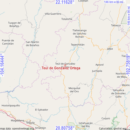
| Upper-left | 22.11628°, | -104.16444° |
| Center: | 21.4634°, | -103.46131° |
| Lower-right: | 20.80758°, | -102.75819° |
| Map W x H: | 145.5×145.5 km | = 90.4×90.4mi |
| max Lat: | 32.7° ⇑18.8% North |
| Teúl de González Ortega: | 21.4634° |
| min Lat: | ⇓81.2% South 14.53588° |
| min Long | Teúl de Gonzá | max Long |
| -117.105° | -103.46131° | -86.73105° |
| W 11.9%⇐ | ⇒88.1% E |
Elevation
Elevation of Teúl de González Ortega is 1912 m = 6273 ft, and this is 658.3 m = 2160 ft above average elevation for this country.
| Max E: |
3497 m = 11473 ft | 30.7% |
| Teúl de González Ortega | 1912 m 6273 ft | |
| Avg. | 1253.7 m = 4113 ft | |
Min E: |
-1 m = -3 ft | 69.3% |
See also: Mexico elevation on elevation.city.
Geographical zone
Teúl de González Ortega is located in North Torrid zone (between Equator and Tropic of Cancer). Distance of this Northern Tropic circle is 219.4 km =136.3 mi to North.| Distance of | km | miles | from Teúl de González Ortega |
|---|---|---|---|
| North Pole | 7620.6 | 4735.2 | to North |
| Arctic Circle | 5014.7 | 3116 | to North |
| Tropic Cancer | 219.4 | 136.3 | to North |
| Equator | 2386.5 | 1482.9 | to South |


Nearby cities:
15 places around Teúl de González Ortega: (largest is in red/bold)
• Bonifacio Falcón
35 km =21.7 mi,  99°
99°
• Cicacalco
32 km =19.9 mi,  28°
28°
• Cuxpala
31 km =19.3 mi,  128°
128°
• Florencia
10.6 km =6.6 mi,  295°
295°
• Huitzila
30.7 km =19.1 mi,  209°
209°
• Juchipila
36.2 km =22.5 mi, 99°
• Mezquital del Oro
29.3 km =18.2 mi,  159°
159°
• Milpillas de Allende
22 km =13.7 mi,  226°
226°
• San José (San José de los Meléndez)
35.1 km =21.8 mi, 97°
• San Pedro Ocotlán
18 km =11.2 mi,  62°
62°
• Santa María de la Paz
7.7 km =4.8 mi,  45°
45°
• Talesteipa
30.7 km =19.1 mi, 30°
• Tepechitlán
26.9 km =16.7 mi, 31°
• Tepizuac
25.7 km =16 mi,  314°
314°
• Trinidad García de la Cadena
28.1 km =17.5 mi,  180°
180°
Sources, notices
• [Note1] Compared only with cities in Mexico existing in our database
• [Src1] Map data: © OpenStreetMap contributors (CC-BY-SA)
• [Src2] Other city data from geonames.org with taken over terms of usage.
• [Src3] Geographical zone / Annual Mean Temperature by Robert A. Rohde @ Wikipedia
