Cuxpala geodata
Cuxpala (Zacatecas) is a populated place; located in Mexico in America/Mexico_City (GMT-6) time zone. With population of 579 people, there are 14804 cities with bigger population in this country. Compared to other cities in Mexico, 79.9% of cities are located further ↓South; 86.7% of cities are located further →East and 52.3% of cities have higher elevation than Cuxpala. Note1


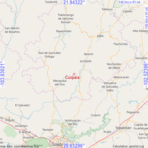
Cuxpala GPS coordinates[2]
21° 17' 22.38" North, 103° 13' 37.488" West
| Map corner | latitude | longitude |
|---|---|---|
| Upper-left | 21.94322°, | -103.93021° |
| Center: | 21.28955°, | -103.22708° |
| Lower-right: | 20.63296°, | -102.52396° |
| Map W x H: | 145.7×145.7 km | = 90.5×90.5mi |
| max Lat: | 32.7° ⇑20.1% North |
| Cuxpala: | 21.28955° |
| min Lat: | ⇓79.9% South 14.53588° |
| min Long | Cuxpala | max Long |
| -117.105° | -103.22708° | -86.73105° |
| W 13.3%⇐ | ⇒86.7% E |
Elevation
Elevation of Cuxpala is 1325 m = 4347 ft, and this is 71.3 m = 234 ft above average elevation for this country.
| Max E: |
3497 m = 11473 ft | 52.3% |
| Cuxpala | 1325 m 4347 ft | |
| Avg. | 1253.7 m = 4113 ft | |
Min E: |
-1 m = -3 ft | 47.7% |
See also: Mexico elevation on elevation.city.
Geographical zone
Cuxpala is located in North Torrid zone (between Equator and Tropic of Cancer). Distance of this Northern Tropic circle is 238.7 km =148.3 mi to North.| Distance of | km | miles | from Cuxpala |
|---|---|---|---|
| North Pole | 7639.9 | 4747.2 | to North |
| Arctic Circle | 5034 | 3128 | to North |
| Tropic Cancer | 238.7 | 148.3 | to North |
| Equator | 2367.2 | 1470.9 | to South |


Nearby cities:
15 places around Cuxpala: (largest is in red/bold)
• Apozol
24.5 km =15.2 mi,  35°
35°
• Bonifacio Falcón
17 km =10.6 mi, 37°
• El Remolino
13.4 km =8.3 mi,  51°
51°
• Huisquilco
30.7 km =19.1 mi,  123°
123°
• Juchipila
17.5 km =10.9 mi, 40°
• Juchitlán
33.1 km =20.6 mi,  146°
146°
• Las Cruces
31.9 km =19.8 mi,  158°
158°
• Los Llamas
27.7 km =17.2 mi,  30°
30°
• Mezquital del Oro
16.2 km =10.1 mi,  240°
240°
• Moyahua de Estrada
6.8 km =4.2 mi,  112°
112°
• San José (San José de los Meléndez)
18 km =11.2 mi, 35°
• San Pedro Ocotlán
28.9 km =18 mi,  343°
343°
• Santa María de la Paz
31 km =19.3 mi,  322°
322°
• Teúl de González Ortega
31 km =19.3 mi,  308°
308°
• Trinidad García de la Cadena
26.2 km =16.3 mi,  250°
250°
Sources, notices
• [Note1] Compared only with cities in Mexico existing in our database
• [Src1] Map data: © OpenStreetMap contributors (CC-BY-SA)
• [Src2] Other city data from geonames.org with taken over terms of usage.
• [Src3] Geographical zone / Annual Mean Temperature by Robert A. Rohde @ Wikipedia
