Milpillas de Allende geodata
Milpillas de Allende (Zacatecas) is a populated place; located in Mexico in America/Mexico_City (GMT-6) time zone. With population of 677 people, there are 12831 cities with bigger population in this country. Compared to other cities in Mexico, 80.3% of cities are located further ↓South; 88.8% of cities are located further →East and 68.8% of cities have lower elevation than Milpillas de Allende. Note1
Current local time in Milpillas de Allende:
08:30 AM, WednesdayDifference from your time zone: hours


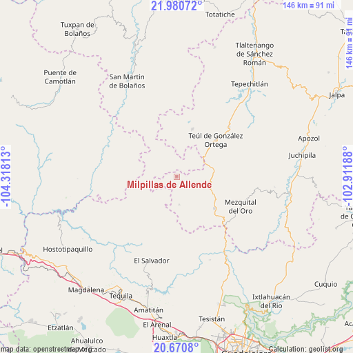
Milpillas de Allende GPS coordinates[2]
21° 19' 37.992" North, 103° 36' 54" West
| Map corner | latitude | longitude |
|---|---|---|
| Upper-left | 21.98072°, | -104.31813° |
| Center: | 21.32722°, | -103.615° |
| Lower-right: | 20.6708°, | -102.91188° |
| Map W x H: | 145.6×145.7 km | = 90.5×90.5mi |
| max Lat: | 32.7° ⇑19.7% North |
| Milpillas de Allende: | 21.32722° |
| min Lat: | ⇓80.3% South 14.53588° |
| min Long | Milpillas de Al | max Long |
| -117.105° | -103.615° | -86.73105° |
| W 11.2%⇐ | ⇒88.8% E |
Elevation
Elevation of Milpillas de Allende is 1903 m = 6243 ft, and this is 649.3 m = 2130 ft above average elevation for this country.
| Max E: |
3497 m = 11473 ft | 31.2% |
| Milpillas de Allende | 1903 m 6243 ft | |
| Avg. | 1253.7 m = 4113 ft | |
Min E: |
-1 m = -3 ft | 68.8% |
See also: Mexico elevation on elevation.city.
Geographical zone
Milpillas de Allende is located in North Torrid zone (between Equator and Tropic of Cancer). Distance of this Northern Tropic circle is 234.6 km =145.8 mi to North.| Distance of | km | miles | from Milpillas de Allende |
|---|---|---|---|
| North Pole | 7635.7 | 4744.6 | to North |
| Arctic Circle | 5029.8 | 3125.4 | to North |
| Tropic Cancer | 234.6 | 145.8 | to North |
| Equator | 2371.4 | 1473.5 | to South |


Nearby cities:
15 places around Milpillas de Allende: (largest is in red/bold)
• Apozolco
32.5 km =20.2 mi,  290°
290°
• Cuxpala
40.4 km =25.1 mi,  95°
95°
• El Salvador
36.1 km =22.4 mi,  196°
196°
• Florencia
20.7 km =12.9 mi,  17°
17°
• Huitzila
11.6 km =7.2 mi,  175°
175°
• La Yesca
41.1 km =25.5 mi,  268°
268°
• Mezquital del Oro
28.9 km =18 mi,  115°
115°
• Moyahua de Estrada
47 km =29.2 mi, 98°
• San Cristóbal de la Barranca
36.9 km =22.9 mi,  148°
148°
• San Martín de Bolaños
44.5 km =27.7 mi,  332°
332°
• San Pedro Ocotlán
39.6 km =24.6 mi,  53°
53°
• Santa María de la Paz
29.7 km =18.5 mi, 46°
• Tepizuac
33.2 km =20.6 mi,  355°
355°
• Teúl de González Ortega
22 km =13.7 mi, 46°
• Trinidad García de la Cadena
20.2 km =12.6 mi,  129°
129°
Sources, notices
• [Note1] Compared only with cities in Mexico existing in our database
• [Src1] Map data: © OpenStreetMap contributors (CC-BY-SA)
• [Src2] Other city data from geonames.org with taken over terms of usage.
• [Src3] Geographical zone / Annual Mean Temperature by Robert A. Rohde @ Wikipedia
