Tequepexpan geodata
Tequepexpan (Nayarit) is a populated place; located in Mexico in America/Mazatlan (GMT-7) time zone. With population of 1,082 people, there are 8049 cities with bigger population in this country. Compared to other cities in Mexico, 79.3% of cities are located further ↓South; 91.2% of cities are located further →East and 50.6% of cities have lower elevation than Tequepexpan. Note1


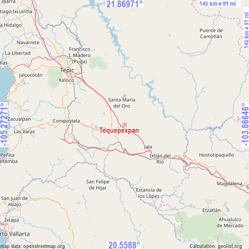
Tequepexpan GPS coordinates[2]
21° 12' 56.556" North, 104° 34' 10.488" West
| Map corner | latitude | longitude |
|---|---|---|
| Upper-left | 21.86971°, | -105.27271° |
| Center: | 21.21571°, | -104.56958° |
| Lower-right: | 20.5588°, | -103.86646° |
| Map W x H: | 145.8×145.8 km | = 90.6×90.6mi |
| max Lat: | 32.7° ⇑20.7% North |
| Tequepexpan: | 21.21571° |
| min Lat: | ⇓79.3% South 14.53588° |
| min Long | Tequepexpan | max Long |
| -117.105° | -104.56958° | -86.73105° |
| W 8.8%⇐ | ⇒91.2% E |
Elevation
Elevation of Tequepexpan is 1463 m = 4800 ft, and this is 209.3 m = 687 ft above average elevation for this country.
| Max E: |
3497 m = 11473 ft | 49.4% |
| Tequepexpan | 1463 m 4800 ft | |
| Avg. | 1253.7 m = 4113 ft | |
Min E: |
-1 m = -3 ft | 50.6% |
See also: Mexico elevation on elevation.city.
Geographical zone
Tequepexpan is located in North Torrid zone (between Equator and Tropic of Cancer). Distance of this Northern Tropic circle is 247 km =153.5 mi to North.| Distance of | km | miles | from Tequepexpan |
|---|---|---|---|
| North Pole | 7648.1 | 4752.3 | to North |
| Arctic Circle | 5042.2 | 3133.1 | to North |
| Tropic Cancer | 247 | 153.5 | to North |
| Equator | 2359 | 1465.8 | to South |


Nearby cities:
15 places around Tequepexpan: (largest is in red/bold)
• Cerro Blanco
18.9 km =11.7 mi,  343°
343°
• Chapalilla
7.7 km =4.8 mi,  246°
246°
• Cofradía de Acuitapilco
15.1 km =9.4 mi,  17°
17°
• El Limón
17.4 km =10.8 mi, 335°
• Heriberto Jara
19 km =11.8 mi,  163°
163°
• Jala
18.4 km =11.4 mi,  132°
132°
• Jomulco
19.6 km =12.2 mi, 129°
• Marquezado
15.4 km =9.6 mi,  181°
181°
• San Pedro Lagunillas
18.9 km =11.7 mi,  271°
271°
• Santa Isabel
8.1 km =5 mi,  223°
223°
• Santa María del Oro
13.3 km =8.3 mi,  352°
352°
• Tetitlán
10.8 km =6.7 mi,  206°
206°
• Uzeta
11.7 km =7.3 mi,  196°
196°
• Valle Verde
11.8 km =7.3 mi, 206°
• Zapotanito
10.8 km =6.7 mi, 337°
Sources, notices
• [Note1] Compared only with cities in Mexico existing in our database
• [Src1] Map data: © OpenStreetMap contributors (CC-BY-SA)
• [Src2] Other city data from geonames.org with taken over terms of usage.
• [Src3] Geographical zone / Annual Mean Temperature by Robert A. Rohde @ Wikipedia
