Tepuzhuacán geodata
Tepuzhuacán (Nayarit) is a populated place; located in Mexico in America/Mazatlan (GMT-7) time zone. With population of 977 people, there are 8897 cities with bigger population in this country. Compared to other cities in Mexico, 74.4% of cities are located further ↓South; 91% of cities are located further →East and 67.1% of cities have higher elevation than Tepuzhuacán. Note1


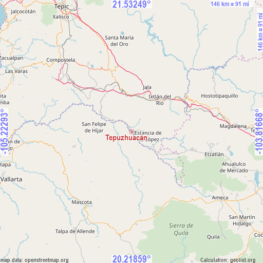
Tepuzhuacán GPS coordinates[2]
20° 52' 37.128" North, 104° 31' 11.28" West
| Map corner | latitude | longitude |
|---|---|---|
| Upper-left | 21.53249°, | -105.22293° |
| Center: | 20.87698°, | -104.5198° |
| Lower-right: | 20.21859°, | -103.81668° |
| Map W x H: | 146.1×146.1 km | = 90.8×90.8mi |
| max Lat: | 32.7° ⇑25.6% North |
| Tepuzhuacán: | 20.87698° |
| min Lat: | ⇓74.4% South 14.53588° |
| min Long | Tepuzhuacán | max Long |
| -117.105° | -104.5198° | -86.73105° |
| W 9%⇐ | ⇒91% E |
Elevation
Elevation of Tepuzhuacán is 581 m = 1906 ft, and this is 672.7 m = 2207 ft below average elevation for this country.
| Max E: |
3497 m = 11473 ft | 67.1% |
| Avg. | 1253.7 m = 4113 ft | |
| Tepuzhuacán | 581 m = 1906 ft | |
Min E: |
-1 m = -3 ft | 32.9% |
See also: Mexico elevation on elevation.city.
Geographical zone
Tepuzhuacán is located in North Torrid zone (between Equator and Tropic of Cancer). Distance of this Northern Tropic circle is 284.6 km =176.8 mi to North.| Distance of | km | miles | from Tepuzhuacán |
|---|---|---|---|
| North Pole | 7685.8 | 4775.7 | to North |
| Arctic Circle | 5079.9 | 3156.5 | to North |
| Tropic Cancer | 284.6 | 176.8 | to North |
| Equator | 2321.3 | 1442.4 | to South |


Nearby cities:
15 places around Tepuzhuacán: (largest is in red/bold)
• Ahuacatlán
20 km =12.4 mi,  10°
10°
• Amatlán de Cañas
14.3 km =8.9 mi,  122°
122°
• El Rosario
5.6 km =3.5 mi,  72°
72°
• Heriberto Jara
19.5 km =12.1 mi,  0°
0°
• Ixtlán del Río
23.7 km =14.7 mi,  40°
40°
• Jala
26.7 km =16.6 mi,  18°
18°
• Jomulco
27.1 km =16.8 mi, 21°
• Los Mezquites
4.9 km =3 mi,  329°
329°
• Marquezado
22.9 km =14.2 mi,  346°
346°
• Méxpan
20.7 km =12.9 mi,  31°
31°
• San Felipe de Híjar
21.2 km =13.2 mi,  277°
277°
• Santa Cruz de Camotlán
18 km =11.2 mi,  299°
299°
• Tetitlán
29.8 km =18.5 mi,  340°
340°
• Uzeta
27.8 km =17.3 mi, 342°
• Valle Verde
29.1 km =18.1 mi, 338°
Sources, notices
• [Note1] Compared only with cities in Mexico existing in our database
• [Src1] Map data: © OpenStreetMap contributors (CC-BY-SA)
• [Src2] Other city data from geonames.org with taken over terms of usage.
• [Src3] Geographical zone / Annual Mean Temperature by Robert A. Rohde @ Wikipedia
