El Tepetate geodata
El Tepetate (San Luis Potosí) is a populated place; located in Mexico in America/Mexico_City (GMT-6) time zone. With population of 1,367 people, there are 6353 cities with bigger population in this country. Compared to other cities in Mexico, 84.3% of cities are located further ↓South; 75.2% of cities are located further →East and 81.6% of cities have lower elevation than El Tepetate. Note1


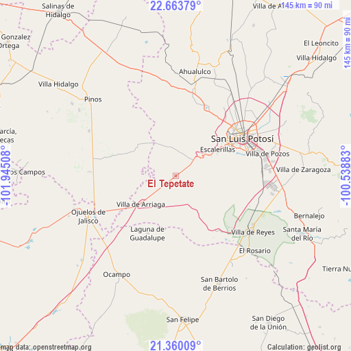
El Tepetate GPS coordinates[2]
22° 0' 48.384" North, 101° 14' 31.02" West
| Map corner | latitude | longitude |
|---|---|---|
| Upper-left | 22.66379°, | -101.94508° |
| Center: | 22.01344°, | -101.24195° |
| Lower-right: | 21.36009°, | -100.53883° |
| Map W x H: | 145×145 km | = 90.1×90.1mi |
| max Lat: | 32.7° ⇑15.7% North |
| El Tepetate: | 22.01344° |
| min Lat: | ⇓84.3% South 14.53588° |
| min Long | El Tepetate | max Long |
| -117.105° | -101.24195° | -86.73105° |
| W 24.8%⇐ | ⇒75.2% E |
Elevation
Elevation of El Tepetate is 2178 m = 7146 ft, and this is 924.3 m = 3032 ft above average elevation for this country.
| Max E: |
3497 m = 11473 ft | 18.4% |
| El Tepetate | 2178 m 7146 ft | |
| Avg. | 1253.7 m = 4113 ft | |
Min E: |
-1 m = -3 ft | 81.6% |
See also: Mexico elevation on elevation.city.
Geographical zone
El Tepetate is located in North Torrid zone (between Equator and Tropic of Cancer). Distance of this Northern Tropic circle is 158.3 km =98.4 mi to North.| Distance of | km | miles | from El Tepetate |
|---|---|---|---|
| North Pole | 7559.4 | 4697.2 | to North |
| Arctic Circle | 4953.5 | 3078 | to North |
| Tropic Cancer | 158.3 | 98.4 | to North |
| Equator | 2447.7 | 1520.9 | to South |


Nearby cities:
15 places around El Tepetate: (largest is in red/bold)
• Bledos
23.1 km =14.4 mi,  145°
145°
• Colonia Emiliano Zapata
8.5 km =5.3 mi,  195°
195°
• Colonia Insurgentes
23 km =14.3 mi,  59°
59°
• Colonia la Laborcilla
16.9 km =10.5 mi,  211°
211°
• Escalerillas
20.5 km =12.7 mi, 57°
• Guadalupe Victoria
24.3 km =15.1 mi,  46°
46°
• La Estrella
26.1 km =16.2 mi,  288°
288°
• La Mesa de los Conejos
21.9 km =13.6 mi, 62°
• La Tapona
23.7 km =14.7 mi,  4°
4°
• Pozuelos
15.6 km =9.7 mi, 57°
• San Antonio
8.2 km =5.1 mi, 54°
• San Francisco
8.7 km =5.4 mi,  100°
100°
• San Luis Gonzaga
8.1 km =5 mi,  319°
319°
• Santa Rosa de Gallinas
17.7 km =11 mi,  245°
245°
• Villa de Arriaga
18.5 km =11.5 mi,  231°
231°
Sources, notices
• [Note1] Compared only with cities in Mexico existing in our database
• [Src1] Map data: © OpenStreetMap contributors (CC-BY-SA)
• [Src2] Other city data from geonames.org with taken over terms of usage.
• [Src3] Geographical zone / Annual Mean Temperature by Robert A. Rohde @ Wikipedia
