San Luis Gonzaga geodata
San Luis Gonzaga (San Luis Potosí) is a populated place; located in Mexico in America/Mexico_City (GMT-6) time zone. With population of 788 people, there are 11082 cities with bigger population in this country. Compared to other cities in Mexico, 84.6% of cities are located further ↓South; 75.6% of cities are located further →East and 79.5% of cities have lower elevation than San Luis Gonzaga. Note1


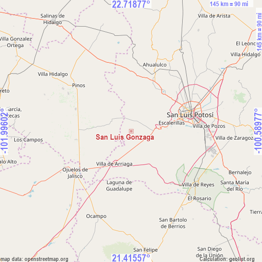
San Luis Gonzaga GPS coordinates[2]
22° 4' 7.212" North, 101° 17' 34.404" West
| Map corner | latitude | longitude |
|---|---|---|
| Upper-left | 22.71877°, | -101.99602° |
| Center: | 22.06867°, | -101.29289° |
| Lower-right: | 21.41557°, | -100.58977° |
| Map W x H: | 144.9×144.9 km | = 90×90mi |
| max Lat: | 32.7° ⇑15.4% North |
| San Luis Gonzaga: | 22.06867° |
| min Lat: | ⇓84.6% South 14.53588° |
| min Long | San Luis Gonzag | max Long |
| -117.105° | -101.29289° | -86.73105° |
| W 24.4%⇐ | ⇒75.6% E |
Elevation
Elevation of San Luis Gonzaga is 2128 m = 6982 ft, and this is 874.3 m = 2868 ft above average elevation for this country.
| Max E: |
3497 m = 11473 ft | 20.5% |
| San Luis Gonzaga | 2128 m 6982 ft | |
| Avg. | 1253.7 m = 4113 ft | |
Min E: |
-1 m = -3 ft | 79.5% |
See also: Mexico elevation on elevation.city.
Geographical zone
San Luis Gonzaga is located in North Torrid zone (between Equator and Tropic of Cancer). Distance of this Northern Tropic circle is 152.1 km =94.5 mi to North.| Distance of | km | miles | from San Luis Gonzaga |
|---|---|---|---|
| North Pole | 7553.3 | 4693.4 | to North |
| Arctic Circle | 4947.4 | 3074.2 | to North |
| Tropic Cancer | 152.1 | 94.5 | to North |
| Equator | 2453.8 | 1524.7 | to South |


Nearby cities:
15 places around San Luis Gonzaga: (largest is in red/bold)
• Cieneguilla
20.5 km =12.7 mi,  316°
316°
• Colonia Emiliano Zapata
14.7 km =9.1 mi,  168°
168°
• Colonia la Laborcilla
20.9 km =13 mi,  189°
189°
• El Tepetate
8.1 km =5 mi,  139°
139°
• Escalerillas
23.1 km =14.4 mi,  78°
78°
• La Estrella
19.6 km =12.2 mi,  275°
275°
• La Mesa de los Conejos
25 km =15.5 mi, 81°
• La Tapona
18.9 km =11.7 mi,  21°
21°
• Pozuelos
18.5 km =11.5 mi, 82°
• San Antonio
12 km =7.5 mi,  96°
96°
• San Francisco
15.8 km =9.8 mi,  119°
119°
• San Martín
19.2 km =11.9 mi,  333°
333°
• Santa Elena
24.5 km =15.2 mi,  245°
245°
• Santa Rosa de Gallinas
17.4 km =10.8 mi,  218°
218°
• Villa de Arriaga
20 km =12.4 mi,  207°
207°
Sources, notices
• [Note1] Compared only with cities in Mexico existing in our database
• [Src1] Map data: © OpenStreetMap contributors (CC-BY-SA)
• [Src2] Other city data from geonames.org with taken over terms of usage.
• [Src3] Geographical zone / Annual Mean Temperature by Robert A. Rohde @ Wikipedia
