San Sebastián del Oeste geodata
San Sebastián del Oeste (Jalisco) is a seat of a second-order administrative division; located in Mexico in America/Mexico_City (GMT-6) time zone. With population of 672 people, there are 12920 cities with bigger population in this country. Compared to other cities in Mexico, 72.7% of cities are located further ↓South; 91.7% of cities are located further →East and 50.6% of cities have higher elevation than San Sebastián del Oeste. Note1
Current local time in San Sebastián del Oeste:
05:07 AM, WednesdayDifference from your time zone: hours


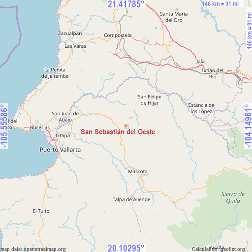
San Sebastián del Oeste GPS coordinates[2]
20° 45' 42.588" North, 104° 51' 9.828" West
| Map corner | latitude | longitude |
|---|---|---|
| Upper-left | 21.41785°, | -105.55586° |
| Center: | 20.76183°, | -104.85273° |
| Lower-right: | 20.10295°, | -104.14961° |
| Map W x H: | 146.2×146.2 km | = 90.8×90.8mi |
| max Lat: | 32.7° ⇑27.3% North |
| San Sebastián del Oeste: | 20.76183° |
| min Lat: | ⇓72.7% South 14.53588° |
| min Long | San Sebastián | max Long |
| -117.105° | -104.85273° | -86.73105° |
| W 8.3%⇐ | ⇒91.7% E |
Elevation
Elevation of San Sebastián del Oeste is 1399 m = 4590 ft, and this is 145.3 m = 477 ft above average elevation for this country.
| Max E: |
3497 m = 11473 ft | 50.6% |
| San Sebastián del Oeste | 1399 m 4590 ft | |
| Avg. | 1253.7 m = 4113 ft | |
Min E: |
-1 m = -3 ft | 49.4% |
See also: Mexico elevation on elevation.city.
Geographical zone
San Sebastián del Oeste is located in North Torrid zone (between Equator and Tropic of Cancer). Distance of this Northern Tropic circle is 297.4 km =184.8 mi to North.| Distance of | km | miles | from San Sebastián del Oeste |
|---|---|---|---|
| North Pole | 7698.6 | 4783.7 | to North |
| Arctic Circle | 5092.7 | 3164.5 | to North |
| Tropic Cancer | 297.4 | 184.8 | to North |
| Equator | 2308.5 | 1434.4 | to South |


Nearby cities:
15 places around San Sebastián del Oeste: (largest is in red/bold)
• Aguamilpa
25.6 km =15.9 mi,  313°
313°
• Cuastecomate
33 km =20.5 mi,  18°
18°
• El Colomo
33.7 km =20.9 mi,  290°
290°
• El Colorado
31.6 km =19.6 mi,  271°
271°
• El Ranchito
31 km =19.3 mi,  264°
264°
• El Zancudo
31.3 km =19.4 mi, 273°
• La Desembocada
31.7 km =19.7 mi, 263°
• Los Mezquites
36.4 km =22.6 mi,  62°
62°
• Mascota
27.1 km =16.8 mi,  165°
165°
• San Felipe de Híjar
20.7 km =12.9 mi,  41°
41°
• San Juan de Abajo
35.7 km =22.2 mi,  279°
279°
• Santa Cruz de Camotlán
28.9 km =18 mi, 41°
• Santiago de Pinos
5.4 km =3.4 mi, 23°
• Tebelchia
31.2 km =19.4 mi, 291°
• Zapotán
36.4 km =22.6 mi,  358°
358°
Sources, notices
• [Note1] Compared only with cities in Mexico existing in our database
• [Src1] Map data: © OpenStreetMap contributors (CC-BY-SA)
• [Src2] Other city data from geonames.org with taken over terms of usage.
• [Src3] Geographical zone / Annual Mean Temperature by Robert A. Rohde @ Wikipedia
