Santiago de Pinos geodata
Santiago de Pinos (Jalisco) is a populated place; located in Mexico in America/Mexico_City (GMT-6) time zone. With population of 556 people, there are 15345 cities with bigger population in this country. Compared to other cities in Mexico, 73.4% of cities are located further ↓South; 91.6% of cities are located further →East and 56.9% of cities have higher elevation than Santiago de Pinos. Note1


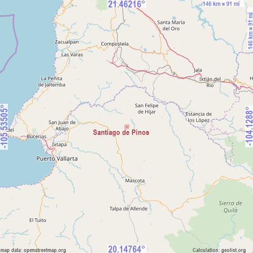
Santiago de Pinos GPS coordinates[2]
20° 48' 22.788" North, 104° 49' 54.912" West
| Map corner | latitude | longitude |
|---|---|---|
| Upper-left | 21.46216°, | -105.53505° |
| Center: | 20.80633°, | -104.83192° |
| Lower-right: | 20.14764°, | -104.1288° |
| Map W x H: | 146.2×146.2 km | = 90.8×90.8mi |
| max Lat: | 32.7° ⇑26.6% North |
| Santiago de Pinos: | 20.80633° |
| min Lat: | ⇓73.4% South 14.53588° |
| min Long | Santiago de Pin | max Long |
| -117.105° | -104.83192° | -86.73105° |
| W 8.4%⇐ | ⇒91.6% E |
Elevation
Elevation of Santiago de Pinos is 1125 m = 3691 ft, and this is 128.7 m = 422 ft below average elevation for this country.
| Max E: |
3497 m = 11473 ft | 56.9% |
| Avg. | 1253.7 m = 4113 ft | |
| Santiago de Pinos | 1125 m = 3691 ft | |
Min E: |
-1 m = -3 ft | 43.1% |
See also: Mexico elevation on elevation.city.
Geographical zone
Santiago de Pinos is located in North Torrid zone (between Equator and Tropic of Cancer). Distance of this Northern Tropic circle is 292.5 km =181.8 mi to North.| Distance of | km | miles | from Santiago de Pinos |
|---|---|---|---|
| North Pole | 7693.6 | 4780.6 | to North |
| Arctic Circle | 5087.7 | 3161.3 | to North |
| Tropic Cancer | 292.5 | 181.8 | to North |
| Equator | 2313.4 | 1437.5 | to South |


Nearby cities:
15 places around Santiago de Pinos: (largest is in red/bold)
• Aguamilpa
24.2 km =15 mi,  301°
301°
• Cuastecomate
27.6 km =17.1 mi,  17°
17°
• El Colomo
34.4 km =21.4 mi,  281°
281°
• El Colorado
34 km =21.1 mi,  263°
263°
• El Ranchito
34 km =21.1 mi, 256°
• El Zancudo
33.5 km =20.8 mi, 264°
• Los Mezquites
32.3 km =20.1 mi,  68°
68°
• Mascota
31.5 km =19.6 mi,  171°
171°
• San Felipe de Híjar
15.6 km =9.7 mi,  47°
47°
• San Sebastián del Oeste
5.4 km =3.4 mi,  203°
203°
• Santa Cruz de Camotlán
23.8 km =14.8 mi, 45°
• Tebelchia
31.9 km =19.8 mi, 281°
• Tepuzhuacán
33.4 km =20.8 mi,  76°
76°
• Tequilita
31.4 km =19.5 mi,  6°
6°
• Zapotán
31.6 km =19.6 mi,  354°
354°
Sources, notices
• [Note1] Compared only with cities in Mexico existing in our database
• [Src1] Map data: © OpenStreetMap contributors (CC-BY-SA)
• [Src2] Other city data from geonames.org with taken over terms of usage.
• [Src3] Geographical zone / Annual Mean Temperature by Robert A. Rohde @ Wikipedia
