San Marcos geodata
San Marcos (Jalisco) is a seat of a second-order administrative division; located in Mexico in America/Mexico_City (GMT-6) time zone. With population of 3,383 people, there are 2685 cities with bigger population in this country. Compared to other cities in Mexico, 73.2% of cities are located further ↓South; 90.4% of cities are located further →East and 51% of cities have higher elevation than San Marcos. Note1


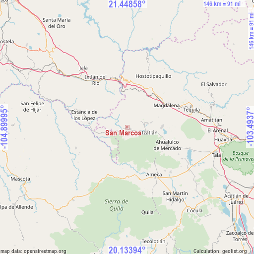
San Marcos GPS coordinates[2]
20° 47' 33.684" North, 104° 11' 48.552" West
| Map corner | latitude | longitude |
|---|---|---|
| Upper-left | 21.44858°, | -104.89995° |
| Center: | 20.79269°, | -104.19682° |
| Lower-right: | 20.13394°, | -103.4937° |
| Map W x H: | 146.2×146.2 km | = 90.8×90.8mi |
| max Lat: | 32.7° ⇑26.8% North |
| San Marcos: | 20.79269° |
| min Lat: | ⇓73.2% South 14.53588° |
| min Long | San Marcos | max Long |
| -117.105° | -104.19682° | -86.73105° |
| W 9.6%⇐ | ⇒90.4% E |
Elevation
Elevation of San Marcos is 1382 m = 4534 ft, and this is 128.3 m = 421 ft above average elevation for this country.
| Max E: |
3497 m = 11473 ft | 51% |
| San Marcos | 1382 m 4534 ft | |
| Avg. | 1253.7 m = 4113 ft | |
Min E: |
-1 m = -3 ft | 49% |
See also: Mexico elevation on elevation.city.
Geographical zone
San Marcos is located in North Torrid zone (between Equator and Tropic of Cancer). Distance of this Northern Tropic circle is 294 km =182.7 mi to North.| Distance of | km | miles | from San Marcos |
|---|---|---|---|
| North Pole | 7695.1 | 4781.5 | to North |
| Arctic Circle | 5089.2 | 3162.3 | to North |
| Tropic Cancer | 294 | 182.7 | to North |
| Equator | 2311.9 | 1436.5 | to South |


Nearby cities:
15 places around San Marcos: (largest is in red/bold)
• Amatlán de Cañas
21.6 km =13.4 mi,  274°
274°
• Antonio Escobedo
18.7 km =11.6 mi,  87°
87°
• Etzatlán
12.7 km =7.9 mi,  102°
102°
• Jayamitla
22.5 km =14 mi,  175°
175°
• La Estancia de Ayones
15.1 km =9.4 mi,  48°
48°
• La Estancita
21.6 km =13.4 mi,  106°
106°
• La Joya
23.5 km =14.6 mi,  75°
75°
• La Mazata
14.8 km =9.2 mi, 49°
• La Villita
23 km =14.3 mi,  173°
173°
• Oconahua
6.5 km =4 mi,  149°
149°
• San Andrés
18.5 km =11.5 mi,  37°
37°
• San Juanito de Escobedo
20.2 km =12.6 mi, 89°
• San Pedro
14.3 km =8.9 mi, 78°
• Santa Rosalía
11.9 km =7.4 mi, 76°
• Santo Tomás
24.2 km =15 mi,  20°
20°
Sources, notices
• [Note1] Compared only with cities in Mexico existing in our database
• [Src1] Map data: © OpenStreetMap contributors (CC-BY-SA)
• [Src2] Other city data from geonames.org with taken over terms of usage.
• [Src3] Geographical zone / Annual Mean Temperature by Robert A. Rohde @ Wikipedia
