La Estancita geodata
La Estancita (Jalisco) is a populated place; located in Mexico in America/Mexico_City (GMT-6) time zone. With population of 656 people, there are 13229 cities with bigger population in this country. Compared to other cities in Mexico, 72.3% of cities are located further ↓South; 89.9% of cities are located further →East and 51.8% of cities have higher elevation than La Estancita. Note1


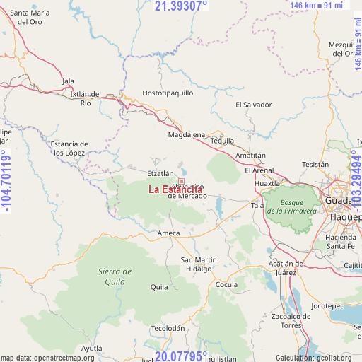
La Estancita GPS coordinates[2]
20° 44' 12.984" North, 103° 59' 53.016" West
| Map corner | latitude | longitude |
|---|---|---|
| Upper-left | 21.39307°, | -104.70119° |
| Center: | 20.73694°, | -103.99806° |
| Lower-right: | 20.07795°, | -103.29494° |
| Map W x H: | 146.2×146.2 km | = 90.8×90.8mi |
| max Lat: | 32.7° ⇑27.7% North |
| La Estancita: | 20.73694° |
| min Lat: | ⇓72.3% South 14.53588° |
| min Long | La Estancita | max Long |
| -117.105° | -103.99806° | -86.73105° |
| W 10.1%⇐ | ⇒89.9% E |
Elevation
Elevation of La Estancita is 1351 m = 4432 ft, and this is 97.3 m = 319 ft above average elevation for this country.
| Max E: |
3497 m = 11473 ft | 51.8% |
| La Estancita | 1351 m 4432 ft | |
| Avg. | 1253.7 m = 4113 ft | |
Min E: |
-1 m = -3 ft | 48.2% |
See also: Mexico elevation on elevation.city.
Geographical zone
La Estancita is located in North Torrid zone (between Equator and Tropic of Cancer). Distance of this Northern Tropic circle is 300.2 km =186.5 mi to North.| Distance of | km | miles | from La Estancita |
|---|---|---|---|
| North Pole | 7701.3 | 4785.4 | to North |
| Arctic Circle | 5095.4 | 3166.1 | to North |
| Tropic Cancer | 300.2 | 186.5 | to North |
| Equator | 2305.7 | 1432.7 | to South |


Nearby cities:
15 places around La Estancita: (largest is in red/bold)
• Ahualulco de Mercado
4.6 km =2.9 mi,  148°
148°
• Antonio Escobedo
7.3 km =4.5 mi,  344°
344°
• Buenos Aires
17.6 km =10.9 mi,  191°
191°
• El Amarillo
16 km =9.9 mi,  137°
137°
• El Carmen
12.9 km =8 mi, 135°
• El Portezuelo
16.1 km =10 mi,  198°
198°
• Etzatlán
9 km =5.6 mi,  292°
292°
• La Joya
12.3 km =7.6 mi,  9°
9°
• Oconahua
17.3 km =10.7 mi,  271°
271°
• Portes Gil
10.7 km =6.6 mi, 144°
• San Juanito de Escobedo
6.4 km =4 mi,  355°
355°
• San Pedro
11.2 km =7 mi,  323°
323°
• Santa Cruz de Bárcenas
7.6 km =4.7 mi,  182°
182°
• Santa Rosalía
12.7 km =7.9 mi,  314°
314°
• Teuchitlán
16.5 km =10.3 mi,  110°
110°
Sources, notices
• [Note1] Compared only with cities in Mexico existing in our database
• [Src1] Map data: © OpenStreetMap contributors (CC-BY-SA)
• [Src2] Other city data from geonames.org with taken over terms of usage.
• [Src3] Geographical zone / Annual Mean Temperature by Robert A. Rohde @ Wikipedia
