Jayamitla geodata
Jayamitla (Jalisco) is a populated place; located in Mexico in America/Mexico_City (GMT-6) time zone. With population of 616 people, there are 13995 cities with bigger population in this country. Compared to other cities in Mexico, 69.8% of cities are located further ↓South; 90.4% of cities are located further →East and 55.1% of cities have higher elevation than Jayamitla. Note1


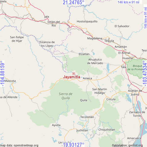
Jayamitla GPS coordinates[2]
20° 35' 27.168" North, 104° 10' 42.456" West
| Map corner | latitude | longitude |
|---|---|---|
| Upper-left | 21.24765°, | -104.88159° |
| Center: | 20.59088°, | -104.17846° |
| Lower-right: | 19.93127°, | -103.47534° |
| Map W x H: | 146.4×146.4 km | = 91×91mi |
| max Lat: | 32.7° ⇑30.2% North |
| Jayamitla: | 20.59088° |
| min Lat: | ⇓69.8% South 14.53588° |
| min Long | Jayamitla | max Long |
| -117.105° | -104.17846° | -86.73105° |
| W 9.6%⇐ | ⇒90.4% E |
Elevation
Elevation of Jayamitla is 1194 m = 3917 ft, and this is 59.7 m = 196 ft below average elevation for this country.
| Max E: |
3497 m = 11473 ft | 55.1% |
| Avg. | 1253.7 m = 4113 ft | |
| Jayamitla | 1194 m = 3917 ft | |
Min E: |
-1 m = -3 ft | 44.9% |
See also: Mexico elevation on elevation.city.
Geographical zone
Jayamitla is located in North Torrid zone (between Equator and Tropic of Cancer). Distance of this Northern Tropic circle is 316.4 km =196.6 mi to North.| Distance of | km | miles | from Jayamitla |
|---|---|---|---|
| North Pole | 7717.6 | 4795.5 | to North |
| Arctic Circle | 5111.7 | 3176.3 | to North |
| Tropic Cancer | 316.4 | 196.6 | to North |
| Equator | 2289.5 | 1422.6 | to South |


Nearby cities:
15 places around Jayamitla: (largest is in red/bold)
• Ahualulco de Mercado
24.5 km =15.2 mi,  59°
59°
• Ameca
14.7 km =9.1 mi,  109°
109°
• Buenos Aires
15.4 km =9.6 mi,  93°
93°
• El Portezuelo
13.8 km =8.6 mi, 85°
• Etzatlán
22.4 km =13.9 mi,  28°
28°
• Guachinango
21.1 km =13.1 mi,  265°
265°
• La Estancita
24.8 km =15.4 mi,  49°
49°
• La Villita
0.8 km =0.5 mi,  124°
124°
• Labor de Solís
20.2 km =12.6 mi,  97°
97°
• Los Pocitos
25.8 km =16 mi, 103°
• Oconahua
16.9 km =10.5 mi,  4°
4°
• San Marcos
22.5 km =14 mi,  355°
355°
• San Nicolás
8 km =5 mi, 115°
• Santa Cruz de Bárcenas
20.3 km =12.6 mi, 64°
• Texcalame
18.7 km =11.6 mi,  143°
143°
Sources, notices
• [Note1] Compared only with cities in Mexico existing in our database
• [Src1] Map data: © OpenStreetMap contributors (CC-BY-SA)
• [Src2] Other city data from geonames.org with taken over terms of usage.
• [Src3] Geographical zone / Annual Mean Temperature by Robert A. Rohde @ Wikipedia
