San Juan Viejo geodata
San Juan Viejo (Guanajuato) is a populated place; located in Mexico in America/Mexico_City (GMT-6) time zone. With population of 734 people, there are 11902 cities with bigger population in this country. Compared to other cities in Mexico, 59% of cities are located further ↓South; 71.5% of cities are located further →East and 66.2% of cities have lower elevation than San Juan Viejo. Note1


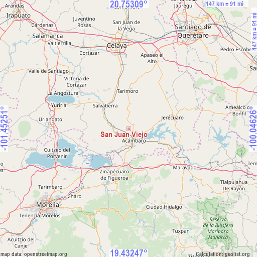
San Juan Viejo GPS coordinates[2]
20° 5' 39.012" North, 100° 44' 57.768" West
| Map corner | latitude | longitude |
|---|---|---|
| Upper-left | 20.75309°, | -101.45251° |
| Center: | 20.09417°, | -100.74938° |
| Lower-right: | 19.43247°, | -100.04626° |
| Map W x H: | 146.8×146.8 km | = 91.2×91.2mi |
| max Lat: | 32.7° ⇑41% North |
| San Juan Viejo: | 20.09417° |
| min Lat: | ⇓59% South 14.53588° |
| min Long | San Juan Viejo | max Long |
| -117.105° | -100.74938° | -86.73105° |
| W 28.5%⇐ | ⇒71.5% E |
Elevation
Elevation of San Juan Viejo is 1855 m = 6086 ft, and this is 601.3 m = 1973 ft above average elevation for this country.
| Max E: |
3497 m = 11473 ft | 33.8% |
| San Juan Viejo | 1855 m 6086 ft | |
| Avg. | 1253.7 m = 4113 ft | |
Min E: |
-1 m = -3 ft | 66.2% |
See also: Mexico elevation on elevation.city.
Geographical zone
San Juan Viejo is located in North Torrid zone (between Equator and Tropic of Cancer). Distance of this Northern Tropic circle is 371.7 km =231 mi to North.| Distance of | km | miles | from San Juan Viejo |
|---|---|---|---|
| North Pole | 7772.8 | 4829.8 | to North |
| Arctic Circle | 5166.9 | 3210.6 | to North |
| Tropic Cancer | 371.7 | 231 | to North |
| Equator | 2234.3 | 1388.3 | to South |


Nearby cities:
15 places around San Juan Viejo: (largest is in red/bold)
• Acámbaro
7.6 km =4.7 mi,  157°
157°
• Agua Caliente
9.8 km =6.1 mi,  127°
127°
• Chamácuaro
8.2 km =5.1 mi,  277°
277°
• El Maguey
6.7 km =4.2 mi,  82°
82°
• Gaytán del Refugio
10.5 km =6.5 mi,  54°
54°
• Jaral del Refugio
3.7 km =2.3 mi, 50°
• La Concepción
9.3 km =5.8 mi,  6°
6°
• La Merced
9.6 km =6 mi,  221°
221°
• Las Jícamas
10.4 km =6.5 mi,  250°
250°
• Monte Prieto
3.6 km =2.2 mi, 253°
• Obrajuelo
10.6 km =6.6 mi, 278°
• Parácuaro
5.7 km =3.5 mi,  345°
345°
• San Cayetano
9.6 km =6 mi,  99°
99°
• San Juan Jaripeo
9.9 km =6.2 mi,  186°
186°
• Solís
8.8 km =5.5 mi,  123°
123°
Sources, notices
• [Note1] Compared only with cities in Mexico existing in our database
• [Src1] Map data: © OpenStreetMap contributors (CC-BY-SA)
• [Src2] Other city data from geonames.org with taken over terms of usage.
• [Src3] Geographical zone / Annual Mean Temperature by Robert A. Rohde @ Wikipedia
