El Reparo geodata
El Reparo (Guerrero) is a populated place; located in Mexico in America/Mexico_City (GMT-6) time zone. With population of 548 people, there are 15532 cities with bigger population in this country. Compared to other cities in Mexico, 77.3% of cities are located further ↑North; 69.6% of cities are located further →East and 72.8% of cities have higher elevation than El Reparo. Note1


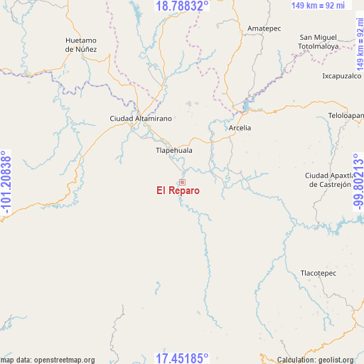
El Reparo GPS coordinates[2]
18° 7' 16.896" North, 100° 30' 18.9" West
| Map corner | latitude | longitude |
|---|---|---|
| Upper-left | 18.78832°, | -101.20838° |
| Center: | 18.12136°, | -100.50525° |
| Lower-right: | 17.45185°, | -99.80213° |
| Map W x H: | 148.6×148.6 km | = 92.3×92.3mi |
| max Lat: | 32.7° ⇑77.3% North |
| El Reparo: | 18.12136° |
| min Lat: | ⇓22.7% South 14.53588° |
| min Long | El Reparo | max Long |
| -117.105° | -100.50525° | -86.73105° |
| W 30.4%⇐ | ⇒69.6% E |
Elevation
Elevation of El Reparo is 297 m = 974 ft, and this is 956.7 m = 3139 ft below average elevation for this country.
| Max E: |
3497 m = 11473 ft | 72.8% |
| Avg. | 1253.7 m = 4113 ft | |
| El Reparo | 297 m = 974 ft | |
Min E: |
-1 m = -3 ft | 27.2% |
See also: Mexico elevation on elevation.city.
Geographical zone
El Reparo is located in North Torrid zone (between Equator and Tropic of Cancer). Distance of this Northern Tropic circle is 591 km =367.2 mi to North.| Distance of | km | miles | from El Reparo |
|---|---|---|---|
| North Pole | 7992.2 | 4966.1 | to North |
| Arctic Circle | 5386.3 | 3346.9 | to North |
| Tropic Cancer | 591 | 367.2 | to North |
| Equator | 2014.9 | 1252 | to South |


Nearby cities:
15 places around El Reparo: (largest is in red/bold)
• Ajuchitlán del Progreso
4.1 km =2.5 mi,  34°
34°
• Ayavitle
8.8 km =5.5 mi,  1°
1°
• Cantón de Guerrero
12.7 km =7.9 mi,  342°
342°
• La Laja
3.4 km =2.1 mi,  135°
135°
• Las Anonitas
12 km =7.5 mi,  321°
321°
• Nuevo Guerrero
11.8 km =7.3 mi,  349°
349°
• San Antonio de la Gavia
13.3 km =8.3 mi,  93°
93°
• San Cristóbal
5.8 km =3.6 mi,  19°
19°
• San Jerónimo el Grande
10 km =6.2 mi, 2°
• San Mateo
8.5 km =5.3 mi, 352°
• San Miguel Totolapan
12.9 km =8 mi,  69°
69°
• San Pedro y las Garzas
3.9 km =2.4 mi,  199°
199°
• Santa Rosa de Lima Dos
6.5 km =4 mi, 315°
• Tlapehuala
13.7 km =8.5 mi, 345°
• Villa Nicolás Bravo
11.3 km =7 mi, 336°
Sources, notices
• [Note1] Compared only with cities in Mexico existing in our database
• [Src1] Map data: © OpenStreetMap contributors (CC-BY-SA)
• [Src2] Other city data from geonames.org with taken over terms of usage.
• [Src3] Geographical zone / Annual Mean Temperature by Robert A. Rohde @ Wikipedia
