San Antonio geodata
San Antonio (Jalisco) is a populated place; located in Mexico in America/Mexico_City (GMT-6) time zone. With population of 669 people, there are 12968 cities with bigger population in this country. Compared to other cities in Mexico, 52.7% of cities are located further ↓South; 89.6% of cities are located further →East and 60.3% of cities have higher elevation than San Antonio. Note1


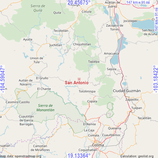
San Antonio GPS coordinates[2]
19° 47' 47.652" North, 103° 53' 14.424" West
| Map corner | latitude | longitude |
|---|---|---|
| Upper-left | 20.45675°, | -104.59047° |
| Center: | 19.79657°, | -103.88734° |
| Lower-right: | 19.13364°, | -103.18422° |
| Map W x H: | 147.1×147.1 km | = 91.4×91.4mi |
| max Lat: | 32.7° ⇑47.3% North |
| San Antonio: | 19.79657° |
| min Lat: | ⇓52.7% South 14.53588° |
| min Long | San Antonio | max Long |
| -117.105° | -103.88734° | -86.73105° |
| W 10.4%⇐ | ⇒89.6% E |
Elevation
Elevation of San Antonio is 981 m = 3219 ft, and this is 272.7 m = 895 ft below average elevation for this country.
| Max E: |
3497 m = 11473 ft | 60.3% |
| Avg. | 1253.7 m = 4113 ft | |
| San Antonio | 981 m = 3219 ft | |
Min E: |
-1 m = -3 ft | 39.7% |
See also: Mexico elevation on elevation.city.
Geographical zone
San Antonio is located in North Torrid zone (between Equator and Tropic of Cancer). Distance of this Northern Tropic circle is 404.7 km =251.5 mi to North.| Distance of | km | miles | from San Antonio |
|---|---|---|---|
| North Pole | 7805.9 | 4850.4 | to North |
| Arctic Circle | 5200 | 3231.1 | to North |
| Tropic Cancer | 404.7 | 251.5 | to North |
| Equator | 2201.2 | 1367.8 | to South |


Nearby cities:
15 places around San Antonio: (largest is in red/bold)
• Alista
20.7 km =12.9 mi,  150°
150°
• Apango
18.5 km =11.5 mi,  95°
95°
• Atacco
20.9 km =13 mi,  46°
46°
• Coatlancillo
13.5 km =8.4 mi,  323°
323°
• El Paso Real
22.7 km =14.1 mi,  199°
199°
• Jiquilpan
11.5 km =7.1 mi, 99°
• Las Primaveras [Invernadero]
12.7 km =7.9 mi, 153°
• Los Colonos
20.2 km =12.6 mi,  36°
36°
• San Gabriel
12.2 km =7.6 mi,  254°
254°
• San Gabriel
13.7 km =8.5 mi,  113°
113°
• San José del Rincón
4.6 km =2.9 mi,  137°
137°
• Tapalpa
21.3 km =13.2 mi, 38°
• Tolimán
21.9 km =13.6 mi,  187°
187°
• Tonaya
8.8 km =5.5 mi,  262°
262°
• Tuxcacuesco
14.9 km =9.3 mi,  222°
222°
Sources, notices
• [Note1] Compared only with cities in Mexico existing in our database
• [Src1] Map data: © OpenStreetMap contributors (CC-BY-SA)
• [Src2] Other city data from geonames.org with taken over terms of usage.
• [Src3] Geographical zone / Annual Mean Temperature by Robert A. Rohde @ Wikipedia
