Tapalpa geodata
Tapalpa (Jalisco) is a seat of a second-order administrative division; located in Mexico in America/Mexico_City (GMT-6) time zone. With population of 5,782 people, there are 1605 cities with bigger population in this country. Compared to other cities in Mexico, 55.9% of cities are located further ↓South; 89.3% of cities are located further →East and 76.8% of cities have lower elevation than Tapalpa. Note1


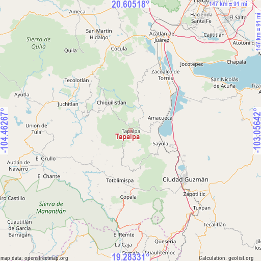
Tapalpa GPS coordinates[2]
19° 56' 44.268" North, 103° 45' 34.344" West
| Map corner | latitude | longitude |
|---|---|---|
| Upper-left | 20.60518°, | -104.46267° |
| Center: | 19.94563°, | -103.75954° |
| Lower-right: | 19.28331°, | -103.05642° |
| Map W x H: | 147×147 km | = 91.3×91.3mi |
| max Lat: | 32.7° ⇑44.1% North |
| Tapalpa: | 19.94563° |
| min Lat: | ⇓55.9% South 14.53588° |
| min Long | Tapalpa | max Long |
| -117.105° | -103.75954° | -86.73105° |
| W 10.7%⇐ | ⇒89.3% E |
Elevation
Elevation of Tapalpa is 2062 m = 6765 ft, and this is 808.3 m = 2652 ft above average elevation for this country.
| Max E: |
3497 m = 11473 ft | 23.2% |
| Tapalpa | 2062 m 6765 ft | |
| Avg. | 1253.7 m = 4113 ft | |
Min E: |
-1 m = -3 ft | 76.8% |
See also: Mexico elevation on elevation.city.
Geographical zone
Tapalpa is located in North Torrid zone (between Equator and Tropic of Cancer). Distance of this Northern Tropic circle is 388.2 km =241.2 mi to North.| Distance of | km | miles | from Tapalpa |
|---|---|---|---|
| North Pole | 7789.3 | 4840 | to North |
| Arctic Circle | 5183.4 | 3220.8 | to North |
| Tropic Cancer | 388.2 | 241.2 | to North |
| Equator | 2217.7 | 1378 | to South |


Nearby cities:
15 places around Tapalpa: (largest is in red/bold)
• Amacueca
18.2 km =11.3 mi,  66°
66°
• Apango
19 km =11.8 mi,  164°
164°
• Atacco
2.8 km =1.7 mi,  139°
139°
• Atemajac de Brizuela
21.6 km =13.4 mi,  9°
9°
• Chiquilistlán
19 km =11.8 mi,  326°
326°
• Ferrería de Tula
13.7 km =8.5 mi, 13°
• Jiquilpan
18.7 km =11.6 mi,  186°
186°
• Juanacatlán
12.3 km =7.6 mi,  38°
38°
• Los Colonos
1.5 km =0.9 mi,  259°
259°
• Los Espinos
5 km =3.1 mi,  25°
25°
• San Antonio
5.8 km =3.6 mi, 65°
• San Antonio
21.3 km =13.2 mi,  218°
218°
• San Gabriel
22 km =13.7 mi,  182°
182°
• Sayula
18.1 km =11.2 mi,  112°
112°
• Tepec
13.3 km =8.3 mi, 68°
Sources, notices
• [Note1] Compared only with cities in Mexico existing in our database
• [Src1] Map data: © OpenStreetMap contributors (CC-BY-SA)
• [Src2] Other city data from geonames.org with taken over terms of usage.
• [Src3] Geographical zone / Annual Mean Temperature by Robert A. Rohde @ Wikipedia
