Coatlancillo geodata
Coatlancillo (Jalisco) is a populated place; located in Mexico in America/Mexico_City (GMT-6) time zone. With population of 565 people, there are 15122 cities with bigger population in this country. Compared to other cities in Mexico, 54.9% of cities are located further ↓South; 89.8% of cities are located further →East and 58.7% of cities have higher elevation than Coatlancillo. Note1


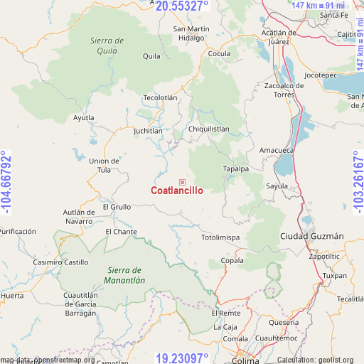
Coatlancillo GPS coordinates[2]
19° 53' 36.6" North, 103° 57' 53.244" West
| Map corner | latitude | longitude |
|---|---|---|
| Upper-left | 20.55327°, | -104.66792° |
| Center: | 19.8935°, | -103.96479° |
| Lower-right: | 19.23097°, | -103.26167° |
| Map W x H: | 147×147 km | = 91.3×91.3mi |
| max Lat: | 32.7° ⇑45.1% North |
| Coatlancillo: | 19.8935° |
| min Lat: | ⇓54.9% South 14.53588° |
| min Long | Coatlancillo | max Long |
| -117.105° | -103.96479° | -86.73105° |
| W 10.2%⇐ | ⇒89.8% E |
Elevation
Elevation of Coatlancillo is 1065 m = 3494 ft, and this is 188.7 m = 619 ft below average elevation for this country.
| Max E: |
3497 m = 11473 ft | 58.7% |
| Avg. | 1253.7 m = 4113 ft | |
| Coatlancillo | 1065 m = 3494 ft | |
Min E: |
-1 m = -3 ft | 41.3% |
See also: Mexico elevation on elevation.city.
Geographical zone
Coatlancillo is located in North Torrid zone (between Equator and Tropic of Cancer). Distance of this Northern Tropic circle is 394 km =244.8 mi to North.| Distance of | km | miles | from Coatlancillo |
|---|---|---|---|
| North Pole | 7795.1 | 4843.6 | to North |
| Arctic Circle | 5189.2 | 3224.4 | to North |
| Tropic Cancer | 394 | 244.8 | to North |
| Equator | 2211.9 | 1374.4 | to South |


Nearby cities:
15 places around Coatlancillo: (largest is in red/bold)
• Atacco
23.5 km =14.6 mi,  80°
80°
• Chiquilistlán
24.2 km =15 mi,  26°
26°
• Ejutla
20.6 km =12.8 mi,  273°
273°
• El Limón
21.4 km =13.3 mi,  249°
249°
• Jiquilpan
23.2 km =14.4 mi,  123°
123°
• Juchitlán
25.5 km =15.8 mi,  326°
326°
• La Ciénega
19.1 km =11.9 mi, 251°
• Los Colonos
20.7 km =12.9 mi,  74°
74°
• Los Guajes
22.3 km =13.9 mi,  343°
343°
• San Antonio
13.5 km =8.4 mi,  143°
143°
• San Gabriel
14.6 km =9.1 mi,  194°
194°
• San José del Rincón
18 km =11.2 mi, 141°
• Tapalpa
22.2 km =13.8 mi, 74°
• Tonaya
11.9 km =7.4 mi,  183°
183°
• Tuxcacuesco
21.8 km =13.5 mi, 185°
Sources, notices
• [Note1] Compared only with cities in Mexico existing in our database
• [Src1] Map data: © OpenStreetMap contributors (CC-BY-SA)
• [Src2] Other city data from geonames.org with taken over terms of usage.
• [Src3] Geographical zone / Annual Mean Temperature by Robert A. Rohde @ Wikipedia
