San Ramón geodata
San Ramón (Jalisco) is a populated place; located in Mexico in America/Mexico_City (GMT-6) time zone. With population of 948 people, there are 9188 cities with bigger population in this country. Compared to other cities in Mexico, 64.6% of cities are located further ↓South; 83.8% of cities are located further →East and 53% of cities have lower elevation than San Ramón. Note1


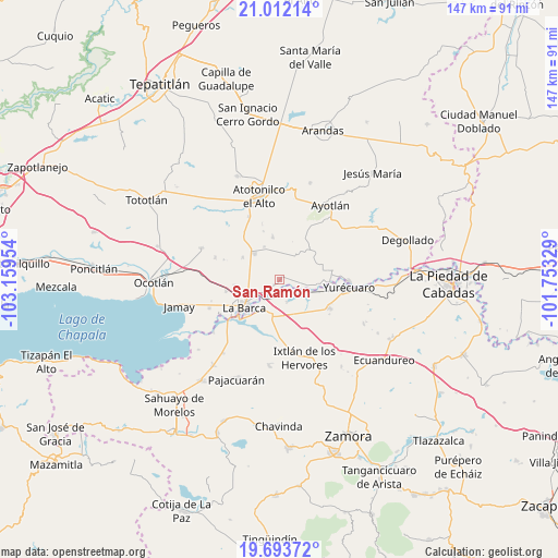
San Ramón GPS coordinates[2]
20° 21' 15.624" North, 102° 27' 23.076" West
| Map corner | latitude | longitude |
|---|---|---|
| Upper-left | 21.01214°, | -103.15954° |
| Center: | 20.35434°, | -102.45641° |
| Lower-right: | 19.69372°, | -101.75329° |
| Map W x H: | 146.6×146.6 km | = 91.1×91.1mi |
| max Lat: | 32.7° ⇑35.4% North |
| San Ramón: | 20.35434° |
| min Lat: | ⇓64.6% South 14.53588° |
| min Long | San Ramón | max Long |
| -117.105° | -102.45641° | -86.73105° |
| W 16.2%⇐ | ⇒83.8% E |
Elevation
Elevation of San Ramón is 1541 m = 5056 ft, and this is 287.3 m = 943 ft above average elevation for this country.
| Max E: |
3497 m = 11473 ft | 47% |
| San Ramón | 1541 m 5056 ft | |
| Avg. | 1253.7 m = 4113 ft | |
Min E: |
-1 m = -3 ft | 53% |
See also: Mexico elevation on elevation.city.
Geographical zone
San Ramón is located in North Torrid zone (between Equator and Tropic of Cancer). Distance of this Northern Tropic circle is 342.7 km =212.9 mi to North.| Distance of | km | miles | from San Ramón |
|---|---|---|---|
| North Pole | 7743.9 | 4811.8 | to North |
| Arctic Circle | 5138 | 3192.6 | to North |
| Tropic Cancer | 342.7 | 212.9 | to North |
| Equator | 2263.2 | 1406.3 | to South |


Nearby cities:
15 places around San Ramón: (largest is in red/bold)
• El Alvareño
6.3 km =3.9 mi,  161°
161°
• El Carmen
6.9 km =4.3 mi,  33°
33°
• El Cuenqueño
3 km =1.9 mi,  182°
182°
• El Gobernador
3.9 km =2.4 mi,  359°
359°
• El Loreto Occidental
2 km =1.2 mi,  228°
228°
• El Mirto
9.3 km =5.8 mi,  271°
271°
• La Paz de Ordaz
7.8 km =4.8 mi,  262°
262°
• Los Pilares
9.2 km =5.7 mi,  110°
110°
• Portezuelo
9.2 km =5.7 mi,  315°
315°
• San Antonio de Rivas
3 km =1.9 mi,  98°
98°
• San José Casas Caídas
7.6 km =4.7 mi,  12°
12°
• Santa Lucía
8.9 km =5.5 mi,  82°
82°
• Villa de García Márquez
9.4 km =5.8 mi,  334°
334°
• Vista Hermosa de Negrete
9.4 km =5.8 mi,  191°
191°
• Zalamea
7.2 km =4.5 mi, 230°
Sources, notices
• [Note1] Compared only with cities in Mexico existing in our database
• [Src1] Map data: © OpenStreetMap contributors (CC-BY-SA)
• [Src2] Other city data from geonames.org with taken over terms of usage.
• [Src3] Geographical zone / Annual Mean Temperature by Robert A. Rohde @ Wikipedia
