Progreso geodata
Progreso (San Luis Potosí) is a populated place; located in Mexico in America/Mexico_City (GMT-6) time zone. With population of 2,144 people, there are 4091 cities with bigger population in this country. Compared to other cities in Mexico, 85.4% of cities are located further ↓South; 65.5% of cities are located further →East and 58.5% of cities have higher elevation than Progreso. Note1


Progreso GPS coordinates[2]
22° 13' 41.988" North, 100° 7' 41.016" West
| Map corner | latitude | longitude |
|---|---|---|
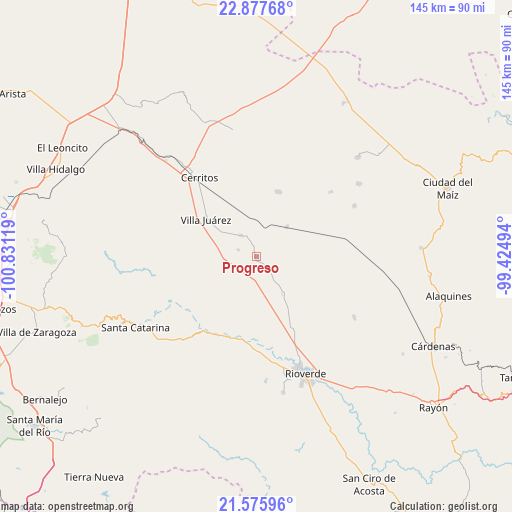
| Upper-left | 22.87768°, | -100.83119° |
| Center: | 22.22833°, | -100.12806° |
| Lower-right: | 21.57596°, | -99.42494° |
| Map W x H: | 144.7×144.7 km | = 89.9×89.9mi |
| max Lat: | 32.7° ⇑14.6% North |
| Progreso: | 22.22833° |
| min Lat: | ⇓85.4% South 14.53588° |
| min Long | Progreso | max Long |
| -117.105° | -100.12806° | -86.73105° |
| W 34.5%⇐ | ⇒65.5% E |
Elevation
Elevation of Progreso is 1083 m = 3553 ft, and this is 170.7 m = 560 ft below average elevation for this country.
| Max E: |
3497 m = 11473 ft | 58.5% |
| Avg. | 1253.7 m = 4113 ft | |
| Progreso | 1083 m = 3553 ft | |
Min E: |
-1 m = -3 ft | 41.5% |
See also: Mexico elevation on elevation.city.
Geographical zone
Progreso is located in North Torrid zone (between Equator and Tropic of Cancer). Distance of this Northern Tropic circle is 134.4 km =83.5 mi to North.| Distance of | km | miles | from Progreso |
|---|---|---|---|
| North Pole | 7535.5 | 4682.3 | to North |
| Arctic Circle | 4929.6 | 3063.1 | to North |
| Tropic Cancer | 134.4 | 83.5 | to North |
| Equator | 2471.6 | 1535.8 | to South |


Nearby cities:
15 places around Progreso: (largest is in red/bold)
• Cerritos
27.5 km =17.1 mi,  324°
324°
• Granjenal
19.3 km =12 mi,  18°
18°
• La Noria
23.7 km =14.7 mi,  177°
177°
• La Reforma
25.8 km =16 mi,  172°
172°
• La Tapona
26.5 km =16.5 mi,  191°
191°
• Labor Vieja
24 km =14.9 mi, 183°
• Ojo de Agua
24.2 km =15 mi,  8°
8°
• Ojo de Agua de Solano
27.5 km =17.1 mi, 169°
• Palo Seco (El Gato)
15.5 km =9.6 mi,  334°
334°
• Pastora
12.6 km =7.8 mi,  144°
144°
• Puerta del Río
13.7 km =8.5 mi,  275°
275°
• San Bartolo
12 km =7.5 mi,  45°
45°
• Santo Domingo
7.5 km =4.7 mi, 324°
• Tanque de los Ángeles
27.9 km =17.3 mi, 48°
• Villa Juárez
18 km =11.2 mi,  307°
307°
Sources, notices
• [Note1] Compared only with cities in Mexico existing in our database
• [Src1] Map data: © OpenStreetMap contributors (CC-BY-SA)
• [Src2] Other city data from geonames.org with taken over terms of usage.
• [Src3] Geographical zone / Annual Mean Temperature by Robert A. Rohde @ Wikipedia
