Las Higueras geodata
Las Higueras (Nayarit) is a populated place; located in Mexico in America/Mazatlan (GMT-7) time zone. With population of 543 people, there are 15651 cities with bigger population in this country. Compared to other cities in Mexico, 83.1% of cities are located further ↓South; 91% of cities are located further →East and 71% of cities have higher elevation than Las Higueras. Note1


Las Higueras GPS coordinates[2]
21° 49' 12.648" North, 104° 31' 16.212" West
| Map corner | latitude | longitude |
|---|---|---|
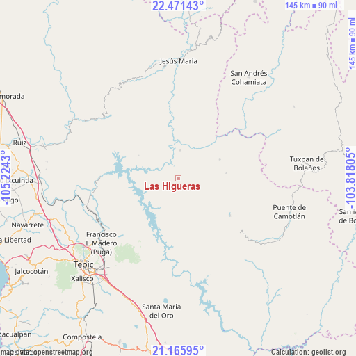
| Upper-left | 22.47143°, | -105.2243° |
| Center: | 21.82018°, | -104.52117° |
| Lower-right: | 21.16595°, | -103.81805° |
| Map W x H: | 145.2×145.2 km | = 90.2×90.2mi |
| max Lat: | 32.7° ⇑16.9% North |
| Las Higueras: | 21.82018° |
| min Lat: | ⇓83.1% South 14.53588° |
| min Long | Las Higueras | max Long |
| -117.105° | -104.52117° | -86.73105° |
| W 9%⇐ | ⇒91% E |
Elevation
Elevation of Las Higueras is 369 m = 1211 ft, and this is 884.7 m = 2903 ft below average elevation for this country.
| Max E: |
3497 m = 11473 ft | 71% |
| Avg. | 1253.7 m = 4113 ft | |
| Las Higueras | 369 m = 1211 ft | |
Min E: |
-1 m = -3 ft | 29% |
See also: Mexico elevation on elevation.city.
Geographical zone
Las Higueras is located in North Torrid zone (between Equator and Tropic of Cancer). Distance of this Northern Tropic circle is 179.7 km =111.7 mi to North.| Distance of | km | miles | from Las Higueras |
|---|---|---|---|
| North Pole | 7580.9 | 4710.6 | to North |
| Arctic Circle | 4975 | 3091.3 | to North |
| Tropic Cancer | 179.7 | 111.7 | to North |
| Equator | 2426.2 | 1507.6 | to South |


Nearby cities:
15 places around Las Higueras: (largest is in red/bold)
• Atonalisco
37.1 km =23.1 mi,  242°
242°
• El Buruato
45.6 km =28.3 mi,  184°
184°
• Francisco I. Madero
40.6 km =25.2 mi,  229°
229°
• Huajimic
26.1 km =16.2 mi,  125°
125°
• Huaynamota
11.4 km =7.1 mi,  4°
4°
• Jesús María Corte
38.9 km =24.2 mi,  253°
253°
• Mojarras
44.8 km =27.8 mi,  191°
191°
• Mora
44.3 km =27.5 mi,  222°
222°
• Naranjito de Copal
22.4 km =13.9 mi, 192°
• Puga
40.8 km =25.4 mi, 229°
• San Andrés
45.2 km =28.1 mi, 238°
• San Fernando
38.3 km =23.8 mi, 225°
• San Luis de Lozada
40.1 km =24.9 mi,  208°
208°
• San Miguel (San Miguel Huaixtita)
34.6 km =21.5 mi,  36°
36°
• Santiago de Pochotitán
32.2 km =20 mi, 214°
Sources, notices
• [Note1] Compared only with cities in Mexico existing in our database
• [Src1] Map data: © OpenStreetMap contributors (CC-BY-SA)
• [Src2] Other city data from geonames.org with taken over terms of usage.
• [Src3] Geographical zone / Annual Mean Temperature by Robert A. Rohde @ Wikipedia
