Mina geodata
Mina (Nuevo León) is a populated place; located in Mexico in America/Monterrey (GMT-6) time zone. With population of 4,495 people, there are 2048 cities with bigger population in this country. Compared to other cities in Mexico, 95.3% of cities are located further ↓South; 69.8% of cities are located further →East and 66.9% of cities have higher elevation than Mina. Note1


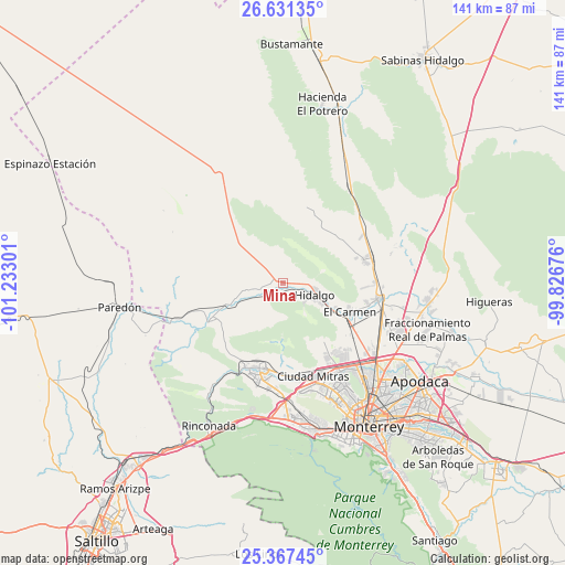
Mina GPS coordinates[2]
26° 0' 3.96" North, 100° 31' 47.568" West
| Map corner | latitude | longitude |
|---|---|---|
| Upper-left | 26.63135°, | -101.23301° |
| Center: | 26.0011°, | -100.52988° |
| Lower-right: | 25.36745°, | -99.82676° |
| Map W x H: | 140.5×140.5 km | = 87.3×87.3mi |
| max Lat: | 32.7° ⇑4.7% North |
| Mina: | 26.0011° |
| min Lat: | ⇓95.3% South 14.53588° |
| min Long | Mina | max Long |
| -117.105° | -100.52988° | -86.73105° |
| W 30.2%⇐ | ⇒69.8% E |
Elevation
Elevation of Mina is 591 m = 1939 ft, and this is 662.7 m = 2174 ft below average elevation for this country.
| Max E: |
3497 m = 11473 ft | 66.9% |
| Avg. | 1253.7 m = 4113 ft | |
| Mina | 591 m = 1939 ft | |
Min E: |
-1 m = -3 ft | 33.1% |
See also: Mexico elevation on elevation.city.
Geographical zone
Mina is located in North temperate zone (between Tropic of Cancer and the Arctic Circle). Distance of this Northern Tropic circle is 285.1 km =177.2 mi to South.| Distance of | km | miles | from Mina |
|---|---|---|---|
| North Pole | 7116 | 4421.7 | to North |
| Arctic Circle | 4510.1 | 2802.4 | to North |
| Tropic Cancer | 285.1 | 177.2 | to South |
| Equator | 2891.1 | 1796.4 | to South |


Nearby cities:
15 places around Mina: (largest is in red/bold)
• Abasolo
14.7 km =9.1 mi,  114°
114°
• Alberto Villarreal
13.4 km =8.3 mi,  118°
118°
• Alianza Real
22.2 km =13.8 mi,  138°
138°
• Buena Vista
23.7 km =14.7 mi,  134°
134°
• Carmen
18.1 km =11.2 mi, 113°
• García
22.1 km =13.7 mi,  198°
198°
• Hidalgo
8.6 km =5.3 mi, 112°
• Las Torres
21.9 km =13.6 mi,  104°
104°
• Las Torres de Guadalupe
23.6 km =14.7 mi, 203°
• Los Morales
21.4 km =13.3 mi,  76°
76°
• Los Villarreales
21.2 km =13.2 mi,  74°
74°
• Praderas de San Francisco
24 km =14.9 mi,  147°
147°
• Unión Agropecuarios Lázaro Cárdenas del Norte
23.8 km =14.8 mi, 142°
• Valle de Lincoln
23.7 km =14.7 mi,  167°
167°
• Valle de San Felipe
23.4 km =14.5 mi,  206°
206°
Sources, notices
• [Note1] Compared only with cities in Mexico existing in our database
• [Src1] Map data: © OpenStreetMap contributors (CC-BY-SA)
• [Src2] Other city data from geonames.org with taken over terms of usage.
• [Src3] Geographical zone / Annual Mean Temperature by Robert A. Rohde @ Wikipedia
