Capilla de Milpillas geodata
Capilla de Milpillas (Jalisco) is a populated place; located in Mexico in America/Mexico_City (GMT-6) time zone. With population of 2,449 people, there are 3605 cities with bigger population in this country. Compared to other cities in Mexico, 71.1% of cities are located further ↓South; 85.2% of cities are located further →East and 64.8% of cities have lower elevation than Capilla de Milpillas. Note1


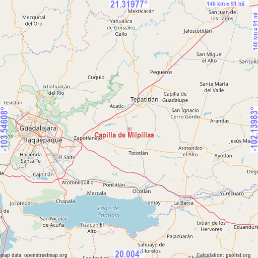
Capilla de Milpillas GPS coordinates[2]
20° 39' 47.916" North, 102° 50' 34.62" West
| Map corner | latitude | longitude |
|---|---|---|
| Upper-left | 21.31977°, | -103.54608° |
| Center: | 20.66331°, | -102.84295° |
| Lower-right: | 20.004°, | -102.13983° |
| Map W x H: | 146.3×146.3 km | = 90.9×90.9mi |
| max Lat: | 32.7° ⇑28.9% North |
| Capilla de Milpillas: | 20.66331° |
| min Lat: | ⇓71.1% South 14.53588° |
| min Long | Capilla de Milp | max Long |
| -117.105° | -102.84295° | -86.73105° |
| W 14.8%⇐ | ⇒85.2% E |
Elevation
Elevation of Capilla de Milpillas is 1823 m = 5981 ft, and this is 569.3 m = 1868 ft above average elevation for this country.
| Max E: |
3497 m = 11473 ft | 35.2% |
| Capilla de Milpillas | 1823 m 5981 ft | |
| Avg. | 1253.7 m = 4113 ft | |
Min E: |
-1 m = -3 ft | 64.8% |
See also: Mexico elevation on elevation.city.
Geographical zone
Capilla de Milpillas is located in North Torrid zone (between Equator and Tropic of Cancer). Distance of this Northern Tropic circle is 308.4 km =191.6 mi to North.| Distance of | km | miles | from Capilla de Milpillas |
|---|---|---|---|
| North Pole | 7709.5 | 4790.5 | to North |
| Arctic Circle | 5103.6 | 3171.2 | to North |
| Tropic Cancer | 308.4 | 191.6 | to North |
| Equator | 2297.5 | 1427.6 | to South |


Nearby cities:
15 places around Capilla de Milpillas: (largest is in red/bold)
• Acatic
14.8 km =9.2 mi,  331°
331°
• Coina Grande
18.7 km =11.6 mi,  146°
146°
• El Refugio
9 km =5.6 mi,  321°
321°
• La Loma (Loma de Enmedio)
18.5 km =11.5 mi,  35°
35°
• Nuevo Refugio de Afuera (Nuevo Refugio)
19 km =11.8 mi,  132°
132°
• Ojo de Agua de Latillas
15.4 km =9.6 mi,  87°
87°
• Ramblas Chico
5.8 km =3.6 mi, 145°
• San Agustín
13.7 km =8.5 mi,  104°
104°
• San Isidro
16.6 km =10.3 mi, 127°
• San Joaquín Zorrillos
18.6 km =11.6 mi,  255°
255°
• San José de las Flores
12.9 km =8 mi, 262°
• Tecomatlán
8.7 km =5.4 mi,  233°
233°
• Tepatitlán de Morelos
19 km =11.8 mi,  25°
25°
• Tierras Coloradas
7.5 km =4.7 mi,  345°
345°
• Tototlán
14.5 km =9 mi,  158°
158°
Sources, notices
• [Note1] Compared only with cities in Mexico existing in our database
• [Src1] Map data: © OpenStreetMap contributors (CC-BY-SA)
• [Src2] Other city data from geonames.org with taken over terms of usage.
• [Src3] Geographical zone / Annual Mean Temperature by Robert A. Rohde @ Wikipedia
