Los Lirios geodata
Los Lirios (Coahuila) is a populated place; located in Mexico in America/Monterrey (GMT-6) time zone. With population of 561 people, there are 15205 cities with bigger population in this country. Compared to other cities in Mexico, 92.4% of cities are located further ↓South; 70.2% of cities are located further →East and 88% of cities have lower elevation than Los Lirios. Note1


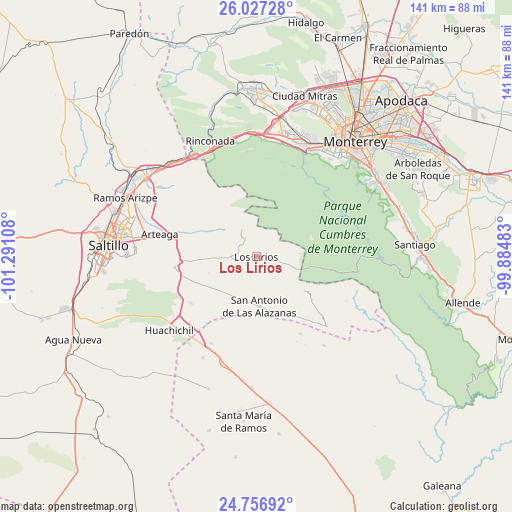
Los Lirios GPS coordinates[2]
25° 23' 37.572" North, 100° 35' 16.62" West
| Map corner | latitude | longitude |
|---|---|---|
| Upper-left | 26.02728°, | -101.29108° |
| Center: | 25.39377°, | -100.58795° |
| Lower-right: | 24.75692°, | -99.88483° |
| Map W x H: | 141.3×141.3 km | = 87.8×87.8mi |
| max Lat: | 32.7° ⇑7.6% North |
| Los Lirios: | 25.39377° |
| min Lat: | ⇓92.4% South 14.53588° |
| min Long | Los Lirios | max Long |
| -117.105° | -100.58795° | -86.73105° |
| W 29.8%⇐ | ⇒70.2% E |
Elevation
Elevation of Los Lirios is 2342 m = 7684 ft, and this is 1088.3 m = 3571 ft above average elevation for this country.
| Max E: |
3497 m = 11473 ft | 12% |
| Los Lirios | 2342 m 7684 ft | |
| Avg. | 1253.7 m = 4113 ft | |
Min E: |
-1 m = -3 ft | 88% |
See also: Mexico elevation on elevation.city.
Geographical zone
Los Lirios is located in North temperate zone (between Tropic of Cancer and the Arctic Circle). Distance of this Northern Tropic circle is 217.6 km =135.2 mi to South.| Distance of | km | miles | from Los Lirios |
|---|---|---|---|
| North Pole | 7183.5 | 4463.6 | to North |
| Arctic Circle | 4577.7 | 2844.5 | to North |
| Tropic Cancer | 217.6 | 135.2 | to South |
| Equator | 2823.5 | 1754.4 | to South |


Nearby cities:
15 places around Los Lirios: (largest is in red/bold)
• Arteaga
26.6 km =16.5 mi,  282°
282°
• Cuatro de Octubre
31.2 km =19.4 mi, 280°
• El Tunal
5.6 km =3.5 mi,  303°
303°
• Huachichil
31.4 km =19.5 mi,  229°
229°
• Monterrey
41.3 km =25.7 mi,  40°
40°
• Navidad
35.9 km =22.3 mi,  182°
182°
• Puerto México
26.8 km =16.7 mi,  207°
207°
• Ramos Arizpe
39.5 km =24.5 mi,  294°
294°
• Saltillo
42 km =26.1 mi,  274°
274°
• San Antonio de las Alazanas
13.6 km =8.5 mi, 175°
• San Pedro Garza Garcia
34.7 km =21.6 mi,  32°
32°
• San Pedro Garza García
34.8 km =21.6 mi, 31°
• San Rafael
40.5 km =25.2 mi,  174°
174°
• Santa Catarina
33.7 km =20.9 mi,  22°
22°
• Santiago
43.9 km =27.3 mi,  85°
85°
Sources, notices
• [Note1] Compared only with cities in Mexico existing in our database
• [Src1] Map data: © OpenStreetMap contributors (CC-BY-SA)
• [Src2] Other city data from geonames.org with taken over terms of usage.
• [Src3] Geographical zone / Annual Mean Temperature by Robert A. Rohde @ Wikipedia
