Las Estacas geodata
Las Estacas (State of Mexico) is a populated place; located in Mexico in America/Mexico_City (GMT-6) time zone. With population of 541 people, there are 15692 cities with bigger population in this country. Compared to other cities in Mexico, 55.3% of cities are located further ↓South; 84.2% of cities are located further →East and 63.7% of cities have lower elevation than Las Estacas. Note1


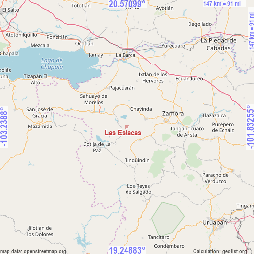
Las Estacas GPS coordinates[2]
19° 54' 40.644" North, 102° 32' 8.412" West
| Map corner | latitude | longitude |
|---|---|---|
| Upper-left | 20.57099°, | -103.2388° |
| Center: | 19.91129°, | -102.53567° |
| Lower-right: | 19.24883°, | -101.83255° |
| Map W x H: | 147×147 km | = 91.3×91.3mi |
| max Lat: | 32.7° ⇑44.7% North |
| Las Estacas: | 19.91129° |
| min Lat: | ⇓55.3% South 14.53588° |
| min Long | Las Estacas | max Long |
| -117.105° | -102.53567° | -86.73105° |
| W 15.8%⇐ | ⇒84.2% E |
Elevation
Elevation of Las Estacas is 1794 m = 5886 ft, and this is 540.3 m = 1773 ft above average elevation for this country.
| Max E: |
3497 m = 11473 ft | 36.3% |
| Las Estacas | 1794 m 5886 ft | |
| Avg. | 1253.7 m = 4113 ft | |
Min E: |
-1 m = -3 ft | 63.7% |
See also: Mexico elevation on elevation.city.
Geographical zone
Las Estacas is located in North Torrid zone (between Equator and Tropic of Cancer). Distance of this Northern Tropic circle is 392 km =243.6 mi to North.| Distance of | km | miles | from Las Estacas |
|---|---|---|---|
| North Pole | 7793.1 | 4842.4 | to North |
| Arctic Circle | 5187.2 | 3223.2 | to North |
| Tropic Cancer | 392 | 243.6 | to North |
| Equator | 2213.9 | 1375.7 | to South |


Nearby cities:
15 places around Las Estacas: (largest is in red/bold)
• Cerrito Colorado
10.7 km =6.6 mi,  4°
4°
• Cerrito de Cotijarán
15.8 km =9.8 mi,  314°
314°
• Chavinda
13.2 km =8.2 mi,  36°
36°
• Churintzio
10 km =6.2 mi,  46°
46°
• El Guayabito
10.5 km =6.5 mi,  66°
66°
• Emiliano Zapata
12.4 km =7.7 mi,  317°
317°
• Guáscuaro de Múgica
12.7 km =7.9 mi,  172°
172°
• La Cantera
14.3 km =8.9 mi,  111°
111°
• Las Zarquillas
14.9 km =9.3 mi, 4°
• Los Hucuares
4.2 km =2.6 mi, 108°
• San Antonio Guaracha
4.4 km =2.7 mi,  331°
331°
• Santiago Tangamandapio
11.6 km =7.2 mi,  64°
64°
• Tarécuato
10.6 km =6.6 mi,  135°
135°
• Telonzo
11.2 km =7 mi, 53°
• Villamar
13.7 km =8.5 mi, 332°
Sources, notices
• [Note1] Compared only with cities in Mexico existing in our database
• [Src1] Map data: © OpenStreetMap contributors (CC-BY-SA)
• [Src2] Other city data from geonames.org with taken over terms of usage.
• [Src3] Geographical zone / Annual Mean Temperature by Robert A. Rohde @ Wikipedia
