Chavinda geodata
Chavinda (Michoacán) is a seat of a second-order administrative division; located in Mexico in America/Mexico_City (GMT-6) time zone. With population of 6,246 people, there are 1491 cities with bigger population in this country. Compared to other cities in Mexico, 57.1% of cities are located further ↓South; 83.8% of cities are located further →East and 54.4% of cities have lower elevation than Chavinda. Note1


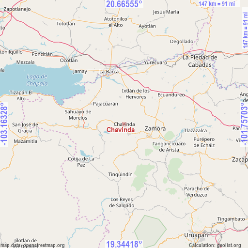
Chavinda GPS coordinates[2]
20° 0' 22.5" North, 102° 27' 36.54" West
| Map corner | latitude | longitude |
|---|---|---|
| Upper-left | 20.66555°, | -103.16328° |
| Center: | 20.00625°, | -102.46015° |
| Lower-right: | 19.34418°, | -101.75703° |
| Map W x H: | 146.9×146.9 km | = 91.3×91.3mi |
| max Lat: | 32.7° ⇑42.9% North |
| Chavinda: | 20.00625° |
| min Lat: | ⇓57.1% South 14.53588° |
| min Long | Chavinda | max Long |
| -117.105° | -102.46015° | -86.73105° |
| W 16.2%⇐ | ⇒83.8% E |
Elevation
Elevation of Chavinda is 1572 m = 5157 ft, and this is 318.3 m = 1044 ft above average elevation for this country.
| Max E: |
3497 m = 11473 ft | 45.6% |
| Chavinda | 1572 m 5157 ft | |
| Avg. | 1253.7 m = 4113 ft | |
Min E: |
-1 m = -3 ft | 54.4% |
See also: Mexico elevation on elevation.city.
Geographical zone
Chavinda is located in North Torrid zone (between Equator and Tropic of Cancer). Distance of this Northern Tropic circle is 381.4 km =237 mi to North.| Distance of | km | miles | from Chavinda |
|---|---|---|---|
| North Pole | 7782.6 | 4835.9 | to North |
| Arctic Circle | 5176.7 | 3216.7 | to North |
| Tropic Cancer | 381.4 | 237 | to North |
| Equator | 2224.5 | 1382.2 | to South |


Nearby cities:
15 places around Chavinda: (largest is in red/bold)
• Ario de Rayón
11.9 km =7.4 mi,  79°
79°
• Cerrito Colorado
7.1 km =4.4 mi,  270°
270°
• Churintzio
3.8 km =2.4 mi,  188°
188°
• El Guayabito
6.5 km =4 mi,  165°
165°
• El Llano
8.9 km =5.5 mi,  72°
72°
• El Tepehuaje
9.6 km =6 mi,  41°
41°
• La Cuestita
7.3 km =4.5 mi,  333°
333°
• La Esperanza
7.5 km =4.7 mi, 43°
• Las Zarquillas
8 km =5 mi,  302°
302°
• Los Hucuares
12.5 km =7.8 mi,  198°
198°
• Rancho Nuevo (Joyas del Pedregal)
11.9 km =7.4 mi,  110°
110°
• Rincón del Mezquite
10.6 km =6.6 mi,  23°
23°
• San Antonio Guaracha
12 km =7.5 mi,  236°
236°
• Santiago Tangamandapio
6.2 km =3.9 mi,  155°
155°
• Telonzo
4.1 km =2.5 mi, 163°
Sources, notices
• [Note1] Compared only with cities in Mexico existing in our database
• [Src1] Map data: © OpenStreetMap contributors (CC-BY-SA)
• [Src2] Other city data from geonames.org with taken over terms of usage.
• [Src3] Geographical zone / Annual Mean Temperature by Robert A. Rohde @ Wikipedia
