Churintzio geodata
Churintzio (Michoacán) is a populated place; located in Mexico in America/Mexico_City (GMT-6) time zone. With population of 692 people, there are 12576 cities with bigger population in this country. Compared to other cities in Mexico, 56.5% of cities are located further ↓South; 83.9% of cities are located further →East and 55.9% of cities have lower elevation than Churintzio. Note1


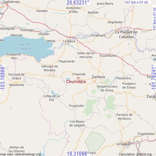
Churintzio GPS coordinates[2]
19° 58' 22.332" North, 102° 27' 55.908" West
| Map corner | latitude | longitude |
|---|---|---|
| Upper-left | 20.63231°, | -103.16866° |
| Center: | 19.97287°, | -102.46553° |
| Lower-right: | 19.31066°, | -101.76241° |
| Map W x H: | 147×147 km | = 91.3×91.3mi |
| max Lat: | 32.7° ⇑43.5% North |
| Churintzio: | 19.97287° |
| min Lat: | ⇓56.5% South 14.53588° |
| min Long | Churintzio | max Long |
| -117.105° | -102.46553° | -86.73105° |
| W 16.1%⇐ | ⇒83.9% E |
Elevation
Elevation of Churintzio is 1615 m = 5299 ft, and this is 361.3 m = 1185 ft above average elevation for this country.
| Max E: |
3497 m = 11473 ft | 44.1% |
| Churintzio | 1615 m 5299 ft | |
| Avg. | 1253.7 m = 4113 ft | |
Min E: |
-1 m = -3 ft | 55.9% |
See also: Mexico elevation on elevation.city.
Geographical zone
Churintzio is located in North Torrid zone (between Equator and Tropic of Cancer). Distance of this Northern Tropic circle is 385.1 km =239.3 mi to North.| Distance of | km | miles | from Churintzio |
|---|---|---|---|
| North Pole | 7786.3 | 4838.2 | to North |
| Arctic Circle | 5180.4 | 3219 | to North |
| Tropic Cancer | 385.1 | 239.3 | to North |
| Equator | 2220.8 | 1379.9 | to South |


Nearby cities:
15 places around Churintzio: (largest is in red/bold)
• Cerrito Colorado
7.6 km =4.7 mi,  300°
300°
• Chavinda
3.8 km =2.4 mi,  8°
8°
• El Guayabito
3.4 km =2.1 mi,  139°
139°
• El Llano
11.1 km =6.9 mi,  54°
54°
• El Tepehuaje
12.9 km =8 mi,  32°
32°
• La Cantera
13.5 km =8.4 mi,  153°
153°
• La Cuestita
10.6 km =6.6 mi,  345°
345°
• La Esperanza
10.8 km =6.7 mi, 31°
• Las Estacas
10 km =6.2 mi,  226°
226°
• Las Zarquillas
10.2 km =6.3 mi,  322°
322°
• Los Hucuares
8.9 km =5.5 mi,  202°
202°
• Rancho Nuevo (Joyas del Pedregal)
11.7 km =7.3 mi,  92°
92°
• San Antonio Guaracha
9.9 km =6.2 mi,  252°
252°
• Santiago Tangamandapio
3.7 km =2.3 mi,  121°
121°
• Telonzo
1.7 km =1.1 mi,  95°
95°
Sources, notices
• [Note1] Compared only with cities in Mexico existing in our database
• [Src1] Map data: © OpenStreetMap contributors (CC-BY-SA)
• [Src2] Other city data from geonames.org with taken over terms of usage.
• [Src3] Geographical zone / Annual Mean Temperature by Robert A. Rohde @ Wikipedia
