La Quemada geodata
La Quemada (Guanajuato) is a populated place; located in Mexico in America/Mexico_City (GMT-6) time zone. With population of 709 people, there are 12279 cities with bigger population in this country. Compared to other cities in Mexico, 80.2% of cities are located further ↓South; 74.3% of cities are located further →East and 73.7% of cities have lower elevation than La Quemada. Note1


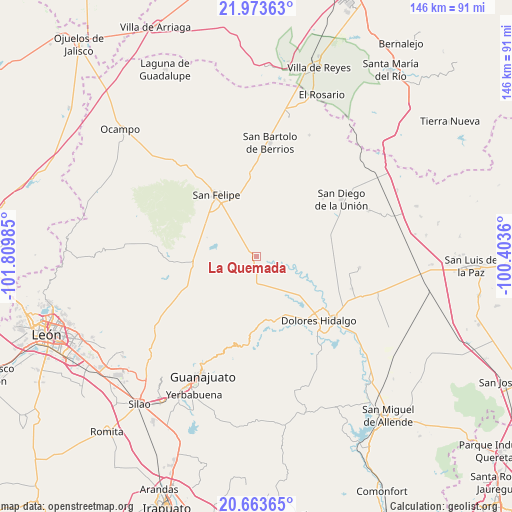
La Quemada GPS coordinates[2]
21° 19' 12.36" North, 101° 6' 24.192" West
| Map corner | latitude | longitude |
|---|---|---|
| Upper-left | 21.97363°, | -101.80985° |
| Center: | 21.3201°, | -101.10672° |
| Lower-right: | 20.66365°, | -100.4036° |
| Map W x H: | 145.7×145.7 km | = 90.5×90.5mi |
| max Lat: | 32.7° ⇑19.8% North |
| La Quemada: | 21.3201° |
| min Lat: | ⇓80.2% South 14.53588° |
| min Long | La Quemada | max Long |
| -117.105° | -101.10672° | -86.73105° |
| W 25.7%⇐ | ⇒74.3% E |
Elevation
Elevation of La Quemada is 2004 m = 6575 ft, and this is 750.3 m = 2462 ft above average elevation for this country.
| Max E: |
3497 m = 11473 ft | 26.3% |
| La Quemada | 2004 m 6575 ft | |
| Avg. | 1253.7 m = 4113 ft | |
Min E: |
-1 m = -3 ft | 73.7% |
See also: Mexico elevation on elevation.city.
Geographical zone
La Quemada is located in North Torrid zone (between Equator and Tropic of Cancer). Distance of this Northern Tropic circle is 235.3 km =146.2 mi to North.| Distance of | km | miles | from La Quemada |
|---|---|---|---|
| North Pole | 7636.5 | 4745.1 | to North |
| Arctic Circle | 5030.6 | 3125.9 | to North |
| Tropic Cancer | 235.3 | 146.2 | to North |
| Equator | 2370.6 | 1473 | to South |


Nearby cities:
15 places around La Quemada: (largest is in red/bold)
• Cantera Sur
17.9 km =11.1 mi,  258°
258°
• El Aposento
11.5 km =7.1 mi,  323°
323°
• El Gallinero
21.6 km =13.4 mi,  135°
135°
• La Cantera
22.2 km =13.8 mi,  150°
150°
• La Estancia del Cubo
7.6 km =4.7 mi,  357°
357°
• La Huerta
14.5 km =9 mi, 322°
• La Labor
3.8 km =2.4 mi,  108°
108°
• Las Yerbas
19.5 km =12.1 mi,  86°
86°
• Los Díaz
19.3 km =12 mi,  335°
335°
• Rancho de Guadalupe
15.3 km =9.5 mi, 139°
• San Andrés del Cubo
14.2 km =8.8 mi,  352°
352°
• San Felipe
20.9 km =13 mi,  327°
327°
• San José de los Barcos
14.8 km =9.2 mi,  265°
265°
• San Juan de Llanos
22.1 km =13.7 mi, 257°
• Soledad Nueva
19.6 km =12.2 mi,  103°
103°
Sources, notices
• [Note1] Compared only with cities in Mexico existing in our database
• [Src1] Map data: © OpenStreetMap contributors (CC-BY-SA)
• [Src2] Other city data from geonames.org with taken over terms of usage.
• [Src3] Geographical zone / Annual Mean Temperature by Robert A. Rohde @ Wikipedia
