Cantera Sur geodata
Cantera Sur (Guanajuato) is a populated place; located in Mexico in America/Mexico_City (GMT-6) time zone. With population of 925 people, there are 9432 cities with bigger population in this country. Compared to other cities in Mexico, 79.9% of cities are located further ↓South; 75.5% of cities are located further →East and 78.6% of cities have lower elevation than Cantera Sur. Note1


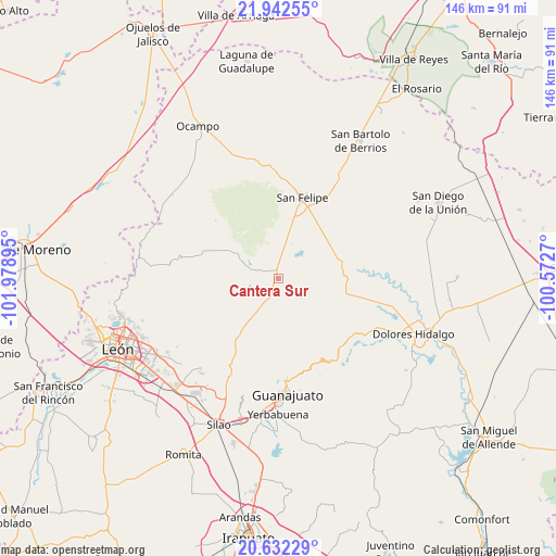
Cantera Sur GPS coordinates[2]
21° 17' 19.968" North, 101° 16' 32.952" West
| Map corner | latitude | longitude |
|---|---|---|
| Upper-left | 21.94255°, | -101.97895° |
| Center: | 21.28888°, | -101.27582° |
| Lower-right: | 20.63229°, | -100.5727° |
| Map W x H: | 145.7×145.7 km | = 90.5×90.5mi |
| max Lat: | 32.7° ⇑20.1% North |
| Cantera Sur: | 21.28888° |
| min Lat: | ⇓79.9% South 14.53588° |
| min Long | Cantera Sur | max Long |
| -117.105° | -101.27582° | -86.73105° |
| W 24.5%⇐ | ⇒75.5% E |
Elevation
Elevation of Cantera Sur is 2103 m = 6900 ft, and this is 849.3 m = 2786 ft above average elevation for this country.
| Max E: |
3497 m = 11473 ft | 21.4% |
| Cantera Sur | 2103 m 6900 ft | |
| Avg. | 1253.7 m = 4113 ft | |
Min E: |
-1 m = -3 ft | 78.6% |
See also: Mexico elevation on elevation.city.
Geographical zone
Cantera Sur is located in North Torrid zone (between Equator and Tropic of Cancer). Distance of this Northern Tropic circle is 238.8 km =148.4 mi to North.| Distance of | km | miles | from Cantera Sur |
|---|---|---|---|
| North Pole | 7640 | 4747.3 | to North |
| Arctic Circle | 5034.1 | 3128 | to North |
| Tropic Cancer | 238.8 | 148.4 | to North |
| Equator | 2367.1 | 1470.8 | to South |


Nearby cities:
15 places around Cantera Sur: (largest is in red/bold)
• Arperos
24.1 km =15 mi,  211°
211°
• El Aposento
16.6 km =10.3 mi,  39°
39°
• La Concepción
21.9 km =13.6 mi,  173°
173°
• La Estancia del Cubo
20.5 km =12.7 mi,  57°
57°
• La Huerta
17.3 km =10.7 mi,  30°
30°
• La Labor
21.3 km =13.2 mi,  83°
83°
• La Quemada
17.9 km =11.1 mi, 78°
• Los Díaz
23.1 km =14.4 mi,  24°
24°
• Los Martínez
13 km =8.1 mi,  259°
259°
• Nuevo Valle de Moreno
17.7 km =11 mi,  240°
240°
• San Andrés del Cubo
23.5 km =14.6 mi, 41°
• San Felipe
22 km =13.7 mi, 16°
• San José de los Barcos
3.6 km =2.2 mi,  51°
51°
• San Juan de Llanos
4.3 km =2.7 mi,  253°
253°
• Vaquerías
19.3 km =12 mi,  219°
219°
Sources, notices
• [Note1] Compared only with cities in Mexico existing in our database
• [Src1] Map data: © OpenStreetMap contributors (CC-BY-SA)
• [Src2] Other city data from geonames.org with taken over terms of usage.
• [Src3] Geographical zone / Annual Mean Temperature by Robert A. Rohde @ Wikipedia
