La Pólvora geodata
La Pólvora (San Luis Potosí) is a populated place; located in Mexico in America/Mexico_City (GMT-6) time zone. With population of 699 people, there are 12460 cities with bigger population in this country. Compared to other cities in Mexico, 87.9% of cities are located further ↓South; 67.8% of cities are located further →East and 52.1% of cities have higher elevation than La Pólvora. Note1


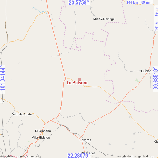
La Pólvora GPS coordinates[2]
22° 55' 47.604" North, 100° 20' 17.916" West
| Map corner | latitude | longitude |
|---|---|---|
| Upper-left | 23.5759°, | -101.04144° |
| Center: | 22.92989°, | -100.33831° |
| Lower-right: | 22.28079°, | -99.63519° |
| Map W x H: | 144×144 km | = 89.5×89.5mi |
| max Lat: | 32.7° ⇑12.1% North |
| La Pólvora: | 22.92989° |
| min Lat: | ⇓87.9% South 14.53588° |
| min Long | La Pólvora | max Long |
| -117.105° | -100.33831° | -86.73105° |
| W 32.2%⇐ | ⇒67.8% E |
Elevation
Elevation of La Pólvora is 1335 m = 4380 ft, and this is 81.3 m = 267 ft above average elevation for this country.
| Max E: |
3497 m = 11473 ft | 52.1% |
| La Pólvora | 1335 m 4380 ft | |
| Avg. | 1253.7 m = 4113 ft | |
Min E: |
-1 m = -3 ft | 47.9% |
See also: Mexico elevation on elevation.city.
Geographical zone
La Pólvora is located in North Torrid zone (between Equator and Tropic of Cancer). Distance of this Northern Tropic circle is 56.4 km =35 mi to North.| Distance of | km | miles | from La Pólvora |
|---|---|---|---|
| North Pole | 7457.5 | 4633.9 | to North |
| Arctic Circle | 4851.6 | 3014.6 | to North |
| Tropic Cancer | 56.4 | 35 | to North |
| Equator | 2549.6 | 1584.2 | to South |


Nearby cities:
15 places around La Pólvora: (largest is in red/bold)
• Abrego
32.5 km =20.2 mi,  186°
186°
• Coyote
24.4 km =15.2 mi,  261°
261°
• El Huisache
6.2 km =3.9 mi, 255°
• Entronque de Matehuala (El Huizache)
12.4 km =7.7 mi,  267°
267°
• La Tapona
35.1 km =21.8 mi,  243°
243°
• La Ventana
11.7 km =7.3 mi,  40°
40°
• Lázaro Cárdenas
29.5 km =18.3 mi,  81°
81°
• Negritas
23.7 km =14.7 mi,  129°
129°
• Norias del Refugio
16.5 km =10.3 mi,  304°
304°
• Núñez
31.8 km =19.8 mi,  212°
212°
• Pozas de Santa Ana
18 km =11.2 mi,  221°
221°
• San Ignacio
33.3 km =20.7 mi,  29°
29°
• San Juan sin Agua
15.3 km =9.5 mi, 273°
• Santa Teresa
23.1 km =14.4 mi,  293°
293°
• Santo Domingo
9.1 km =5.7 mi,  141°
141°
Sources, notices
• [Note1] Compared only with cities in Mexico existing in our database
• [Src1] Map data: © OpenStreetMap contributors (CC-BY-SA)
• [Src2] Other city data from geonames.org with taken over terms of usage.
• [Src3] Geographical zone / Annual Mean Temperature by Robert A. Rohde @ Wikipedia
