Núñez geodata
Núñez (San Luis Potosí) is a populated place; located in Mexico in America/Mexico_City (GMT-6) time zone. With population of 817 people, there are 10690 cities with bigger population in this country. Compared to other cities in Mexico, 87.3% of cities are located further ↓South; 69.6% of cities are located further →East and 50.6% of cities have lower elevation than Núñez. Note1


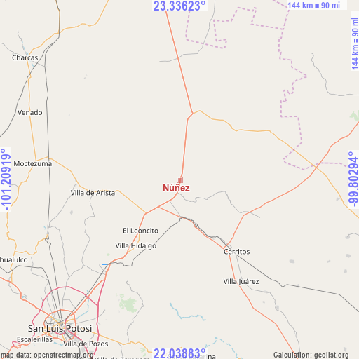
Núñez GPS coordinates[2]
22° 41' 20.652" North, 100° 30' 21.816" West
| Map corner | latitude | longitude |
|---|---|---|
| Upper-left | 23.33623°, | -101.20919° |
| Center: | 22.68907°, | -100.50606° |
| Lower-right: | 22.03883°, | -99.80294° |
| Map W x H: | 144.3×144.3 km | = 89.7×89.7mi |
| max Lat: | 32.7° ⇑12.7% North |
| Núñez: | 22.68907° |
| min Lat: | ⇓87.3% South 14.53588° |
| min Long | Núñez | max Long |
| -117.105° | -100.50606° | -86.73105° |
| W 30.4%⇐ | ⇒69.6% E |
Elevation
Elevation of Núñez is 1467 m = 4813 ft, and this is 213.3 m = 700 ft above average elevation for this country.
| Max E: |
3497 m = 11473 ft | 49.4% |
| Núñez | 1467 m 4813 ft | |
| Avg. | 1253.7 m = 4113 ft | |
Min E: |
-1 m = -3 ft | 50.6% |
See also: Mexico elevation on elevation.city.
Geographical zone
Núñez is located in North Torrid zone (between Equator and Tropic of Cancer). Distance of this Northern Tropic circle is 83.1 km =51.6 mi to North.| Distance of | km | miles | from Núñez |
|---|---|---|---|
| North Pole | 7484.3 | 4650.5 | to North |
| Arctic Circle | 4878.4 | 3031.3 | to North |
| Tropic Cancer | 83.1 | 51.6 | to North |
| Equator | 2522.8 | 1567.6 | to South |


Nearby cities:
15 places around Núñez: (largest is in red/bold)
• Abrego
14.6 km =9.1 mi,  112°
112°
• Charco Blanco
6.4 km =4 mi,  193°
193°
• Coyote
24 km =14.9 mi,  343°
343°
• El Charquito
20.4 km =12.7 mi,  250°
250°
• El Huisache
27.6 km =17.1 mi,  23°
23°
• Entronque de Matehuala (El Huizache)
26.7 km =16.6 mi,  10°
10°
• Guadalcázar
13.5 km =8.4 mi,  125°
125°
• Joya de Luna
29.5 km =18.3 mi,  163°
163°
• La Tapona
18 km =11.2 mi,  307°
307°
• Peotillos
24.2 km =15 mi,  206°
206°
• Peyote
10.9 km =6.8 mi, 249°
• Pozas de Santa Ana
14.3 km =8.9 mi, 21°
• Salitrillo
23.1 km =14.4 mi,  258°
258°
• San Juan sin Agua
27.7 km =17.2 mi,  3°
3°
• San Lorenzo
20.5 km =12.7 mi,  225°
225°
Sources, notices
• [Note1] Compared only with cities in Mexico existing in our database
• [Src1] Map data: © OpenStreetMap contributors (CC-BY-SA)
• [Src2] Other city data from geonames.org with taken over terms of usage.
• [Src3] Geographical zone / Annual Mean Temperature by Robert A. Rohde @ Wikipedia
