La Moreña geodata
La Moreña (Nuevo León) is a populated place; located in Mexico in America/Monterrey (GMT-6) time zone. With population of 512 people, there are 16417 cities with bigger population in this country. Compared to other cities in Mexico, 88.7% of cities are located further ↓South; 67.6% of cities are located further →East and 65.6% of cities have lower elevation than La Moreña. Note1


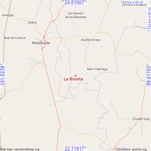
La Moreña GPS coordinates[2]
23° 21' 58.284" North, 100° 19' 14.772" West
| Map corner | latitude | longitude |
|---|---|---|
| Upper-left | 24.01007°, | -101.0239° |
| Center: | 23.36619°, | -100.32077° |
| Lower-right: | 22.71917°, | -99.61765° |
| Map W x H: | 143.5×143.5 km | = 89.2×89.2mi |
| max Lat: | 32.7° ⇑11.3% North |
| La Moreña: | 23.36619° |
| min Lat: | ⇓88.7% South 14.53588° |
| min Long | La Moreña | max Long |
| -117.105° | -100.32077° | -86.73105° |
| W 32.4%⇐ | ⇒67.6% E |
Elevation
Elevation of La Moreña is 1844 m = 6050 ft, and this is 590.3 m = 1937 ft above average elevation for this country.
| Max E: |
3497 m = 11473 ft | 34.4% |
| La Moreña | 1844 m 6050 ft | |
| Avg. | 1253.7 m = 4113 ft | |
Min E: |
-1 m = -3 ft | 65.6% |
See also: Mexico elevation on elevation.city.
Geographical zone
La Moreña is located in North Torrid zone (between Equator and Tropic of Cancer). Distance of this Northern Tropic circle is 7.8 km =4.8 mi to North.| Distance of | km | miles | from La Moreña |
|---|---|---|---|
| North Pole | 7409 | 4603.7 | to North |
| Arctic Circle | 4803.1 | 2984.5 | to North |
| Tropic Cancer | 7.8 | 4.8 | to North |
| Equator | 2598.1 | 1614.4 | to South |


Nearby cities:
15 places around La Moreña: (largest is in red/bold)
• Cerros Blancos
13.8 km =8.6 mi,  103°
103°
• Doctor Arroyo
36.9 km =22.9 mi,  22°
22°
• La Cardona
35 km =21.7 mi,  83°
83°
• La Ventana
40 km =24.9 mi,  171°
171°
• Las Palomas (Lajillas)
24.6 km =15.3 mi,  35°
35°
• Matehuala
45.4 km =28.2 mi,  313°
313°
• Mier y Noriega
21.7 km =13.5 mi,  73°
73°
• Norias del Refugio
42.2 km =26.2 mi,  201°
201°
• Sacramento
45.4 km =28.2 mi, 307°
• San Ignacio
24.3 km =15.1 mi,  143°
143°
• San José del Llano
43.6 km =27.1 mi,  64°
64°
• Santa Cruz
32.2 km =20 mi,  250°
250°
• Santa Rosa La Masita
37.5 km =23.3 mi,  231°
231°
• Santa Teresa
45.3 km =28.1 mi,  210°
210°
• Villa de Guadalupe
44.5 km =27.7 mi,  271°
271°
Sources, notices
• [Note1] Compared only with cities in Mexico existing in our database
• [Src1] Map data: © OpenStreetMap contributors (CC-BY-SA)
• [Src2] Other city data from geonames.org with taken over terms of usage.
• [Src3] Geographical zone / Annual Mean Temperature by Robert A. Rohde @ Wikipedia
