Villa de Guadalupe geodata
Villa de Guadalupe (San Luis Potosí) is a seat of a second-order administrative division; located in Mexico in America/Mexico_City (GMT-6) time zone. With population of 971 people, there are 8951 cities with bigger population in this country. Compared to other cities in Mexico, 88.7% of cities are located further ↓South; 71.5% of cities are located further →East and 56.3% of cities have lower elevation than Villa de Guadalupe. Note1


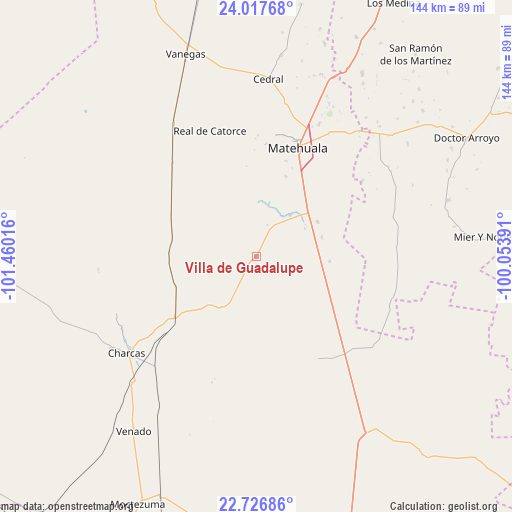
Villa de Guadalupe GPS coordinates[2]
23° 22' 25.824" North, 100° 45' 25.308" West
| Map corner | latitude | longitude |
|---|---|---|
| Upper-left | 24.01768°, | -101.46016° |
| Center: | 23.37384°, | -100.75703° |
| Lower-right: | 22.72686°, | -100.05391° |
| Map W x H: | 143.5×143.5 km | = 89.2×89.2mi |
| max Lat: | 32.7° ⇑11.3% North |
| Villa de Guadalupe: | 23.37384° |
| min Lat: | ⇓88.7% South 14.53588° |
| min Long | Villa de Guadal | max Long |
| -117.105° | -100.75703° | -86.73105° |
| W 28.5%⇐ | ⇒71.5% E |
Elevation
Elevation of Villa de Guadalupe is 1630 m = 5348 ft, and this is 376.3 m = 1235 ft above average elevation for this country.
| Max E: |
3497 m = 11473 ft | 43.7% |
| Villa de Guadalupe | 1630 m 5348 ft | |
| Avg. | 1253.7 m = 4113 ft | |
Min E: |
-1 m = -3 ft | 56.3% |
See also: Mexico elevation on elevation.city.
Geographical zone
Villa de Guadalupe is located in North Torrid zone (between Equator and Tropic of Cancer). Distance of this Northern Tropic circle is 7 km =4.3 mi to North.| Distance of | km | miles | from Villa de Guadalupe |
|---|---|---|---|
| North Pole | 7408.1 | 4603.2 | to North |
| Arctic Circle | 4802.2 | 2983.9 | to North |
| Tropic Cancer | 7 | 4.3 | to North |
| Equator | 2598.9 | 1614.9 | to South |


Nearby cities:
15 places around Villa de Guadalupe: (largest is in red/bold)
• Cañada Verde
48.5 km =30.1 mi,  226°
226°
• Charcas
45.4 km =28.2 mi, 233°
• Estación Wadley
35.5 km =22.1 mi,  318°
318°
• La Moreña
44.5 km =27.7 mi,  91°
91°
• Matehuala
32.6 km =20.3 mi,  20°
20°
• Norias del Refugio
49.6 km =30.8 mi,  143°
143°
• Real de Catorce
37.6 km =23.4 mi,  339°
339°
• Sacramento
28 km =17.4 mi, 17°
• Santa Cruz
18.3 km =11.4 mi,  129°
129°
• Santa Rosa La Masita
28.5 km =17.7 mi,  147°
147°
• Santa Teresa
45.5 km =28.3 mi, 151°
• Tanque Colorado
18.1 km =11.2 mi,  8°
8°
• Villa de la Paz
33.9 km =21.1 mi, 7°
• Zaragoza de Solís
15.7 km =9.8 mi,  207°
207°
• Álvaro Obregón (Estación los Charcos)
41.7 km =25.9 mi,  222°
222°
Sources, notices
• [Note1] Compared only with cities in Mexico existing in our database
• [Src1] Map data: © OpenStreetMap contributors (CC-BY-SA)
• [Src2] Other city data from geonames.org with taken over terms of usage.
• [Src3] Geographical zone / Annual Mean Temperature by Robert A. Rohde @ Wikipedia
