Mantequilla geodata
Mantequilla (San Luis Potosí) is a populated place; located in Mexico in America/Mexico_City (GMT-6) time zone. With population of 646 people, there are 13395 cities with bigger population in this country. Compared to other cities in Mexico, 86.4% of cities are located further ↓South; 72.5% of cities are located further →East and 66.4% of cities have lower elevation than Mantequilla. Note1


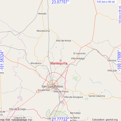
Mantequilla GPS coordinates[2]
22° 25' 43.212" North, 100° 52' 48.396" West
| Map corner | latitude | longitude |
|---|---|---|
| Upper-left | 23.07707°, | -101.58324° |
| Center: | 22.42867°, | -100.88011° |
| Lower-right: | 21.77722°, | -100.17699° |
| Map W x H: | 144.5×144.5 km | = 89.8×89.8mi |
| max Lat: | 32.7° ⇑13.6% North |
| Mantequilla: | 22.42867° |
| min Lat: | ⇓86.4% South 14.53588° |
| min Long | Mantequilla | max Long |
| -117.105° | -100.88011° | -86.73105° |
| W 27.5%⇐ | ⇒72.5% E |
Elevation
Elevation of Mantequilla is 1858 m = 6096 ft, and this is 604.3 m = 1983 ft above average elevation for this country.
| Max E: |
3497 m = 11473 ft | 33.6% |
| Mantequilla | 1858 m 6096 ft | |
| Avg. | 1253.7 m = 4113 ft | |
Min E: |
-1 m = -3 ft | 66.4% |
See also: Mexico elevation on elevation.city.
Geographical zone
Mantequilla is located in North Torrid zone (between Equator and Tropic of Cancer). Distance of this Northern Tropic circle is 112.1 km =69.7 mi to North.| Distance of | km | miles | from Mantequilla |
|---|---|---|---|
| North Pole | 7513.2 | 4668.5 | to North |
| Arctic Circle | 4907.3 | 3049.3 | to North |
| Tropic Cancer | 112.1 | 69.7 | to North |
| Equator | 2493.8 | 1549.6 | to South |


Nearby cities:
15 places around Mantequilla: (largest is in red/bold)
• Bocas
17.6 km =10.9 mi,  304°
304°
• Cerrito de Zavala
15.6 km =9.7 mi,  320°
320°
• Corcovado
19.6 km =12.2 mi,  100°
100°
• Derramaderos
16.6 km =10.3 mi,  341°
341°
• Ejido de Moras
18.7 km =11.6 mi,  219°
219°
• El Peñasco
13.6 km =8.5 mi,  212°
212°
• Enrique Estrada
21 km =13 mi,  182°
182°
• Estación Ventura
12 km =7.5 mi,  112°
112°
• Estanzuela
22.1 km =13.7 mi, 216°
• La Melada
10.5 km =6.5 mi, 299°
• Pedrera del Tanquito
13.3 km =8.3 mi, 108°
• Puerto de Providencia
20.3 km =12.6 mi,  249°
249°
• Rinconada
20.8 km =12.9 mi,  200°
200°
• San Pedro Ojo Zarco
18.5 km =11.5 mi,  232°
232°
• Villa Hidalgo
20.9 km =13 mi,  83°
83°
Sources, notices
• [Note1] Compared only with cities in Mexico existing in our database
• [Src1] Map data: © OpenStreetMap contributors (CC-BY-SA)
• [Src2] Other city data from geonames.org with taken over terms of usage.
• [Src3] Geographical zone / Annual Mean Temperature by Robert A. Rohde @ Wikipedia
