Derramaderos geodata
Derramaderos (San Luis Potosí) is a populated place; located in Mexico in America/Mexico_City (GMT-6) time zone. With population of 1,424 people, there are 6068 cities with bigger population in this country. Compared to other cities in Mexico, 87% of cities are located further ↓South; 72.9% of cities are located further →East and 57% of cities have lower elevation than Derramaderos. Note1


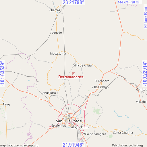
Derramaderos GPS coordinates[2]
22° 34' 12.9" North, 100° 55' 56.136" West
| Map corner | latitude | longitude |
|---|---|---|
| Upper-left | 23.21798°, | -101.63539° |
| Center: | 22.57025°, | -100.93226° |
| Lower-right: | 21.91946°, | -100.22914° |
| Map W x H: | 144.4×144.4 km | = 89.7×89.7mi |
| max Lat: | 32.7° ⇑13% North |
| Derramaderos: | 22.57025° |
| min Lat: | ⇓87% South 14.53588° |
| min Long | Derramaderos | max Long |
| -117.105° | -100.93226° | -86.73105° |
| W 27.1%⇐ | ⇒72.9% E |
Elevation
Elevation of Derramaderos is 1656 m = 5433 ft, and this is 402.3 m = 1320 ft above average elevation for this country.
| Max E: |
3497 m = 11473 ft | 43% |
| Derramaderos | 1656 m 5433 ft | |
| Avg. | 1253.7 m = 4113 ft | |
Min E: |
-1 m = -3 ft | 57% |
See also: Mexico elevation on elevation.city.
Geographical zone
Derramaderos is located in North Torrid zone (between Equator and Tropic of Cancer). Distance of this Northern Tropic circle is 96.3 km =59.8 mi to North.| Distance of | km | miles | from Derramaderos |
|---|---|---|---|
| North Pole | 7497.5 | 4658.7 | to North |
| Arctic Circle | 4891.6 | 3039.5 | to North |
| Tropic Cancer | 96.3 | 59.8 | to North |
| Equator | 2509.6 | 1559.4 | to South |


Nearby cities:
15 places around Derramaderos: (largest is in red/bold)
• Bocas
10.9 km =6.8 mi,  237°
237°
• Cerrito de Zavala
5.9 km =3.7 mi,  230°
230°
• Colonia Emiliano Zapata (El Chamizal)
25.9 km =16.1 mi,  223°
223°
• El Charquito
25.4 km =15.8 mi,  75°
75°
• El Zapote (Cerrito Blanco)
22.4 km =13.9 mi, 236°
• Estación Ventura
26.2 km =16.3 mi,  141°
141°
• González
6.7 km =4.2 mi,  359°
359°
• La Manta
10.1 km =6.3 mi,  307°
307°
• La Melada
11.2 km =7 mi,  199°
199°
• Mantequilla
16.6 km =10.3 mi,  161°
161°
• Moctezuma
25 km =15.5 mi,  322°
322°
• Morados
25.1 km =15.6 mi, 310°
• Salitrillo
22.8 km =14.2 mi,  67°
67°
• San José del Arbolito
15.1 km =9.4 mi,  36°
36°
• Villa de Arista
11.8 km =7.3 mi,  47°
47°
Sources, notices
• [Note1] Compared only with cities in Mexico existing in our database
• [Src1] Map data: © OpenStreetMap contributors (CC-BY-SA)
• [Src2] Other city data from geonames.org with taken over terms of usage.
• [Src3] Geographical zone / Annual Mean Temperature by Robert A. Rohde @ Wikipedia
