Portes Gil geodata
Portes Gil (Jalisco) is a populated place; located in Mexico in America/Mexico_City (GMT-6) time zone. With population of 2,353 people, there are 3755 cities with bigger population in this country. Compared to other cities in Mexico, 71% of cities are located further ↓South; 89.8% of cities are located further →East and 52.7% of cities have higher elevation than Portes Gil. Note1


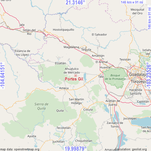
Portes Gil GPS coordinates[2]
20° 39' 29.232" North, 103° 56' 18.168" West
| Map corner | latitude | longitude |
|---|---|---|
| Upper-left | 21.3146°, | -104.64151° |
| Center: | 20.65812°, | -103.93838° |
| Lower-right: | 19.99879°, | -103.23526° |
| Map W x H: | 146.3×146.3 km | = 90.9×90.9mi |
| max Lat: | 32.7° ⇑29% North |
| Portes Gil: | 20.65812° |
| min Lat: | ⇓71% South 14.53588° |
| min Long | Portes Gil | max Long |
| -117.105° | -103.93838° | -86.73105° |
| W 10.2%⇐ | ⇒89.8% E |
Elevation
Elevation of Portes Gil is 1307 m = 4288 ft, and this is 53.3 m = 175 ft above average elevation for this country.
| Max E: |
3497 m = 11473 ft | 52.7% |
| Portes Gil | 1307 m 4288 ft | |
| Avg. | 1253.7 m = 4113 ft | |
Min E: |
-1 m = -3 ft | 47.3% |
See also: Mexico elevation on elevation.city.
Geographical zone
Portes Gil is located in North Torrid zone (between Equator and Tropic of Cancer). Distance of this Northern Tropic circle is 309 km =192 mi to North.| Distance of | km | miles | from Portes Gil |
|---|---|---|---|
| North Pole | 7710.1 | 4790.8 | to North |
| Arctic Circle | 5104.2 | 3171.6 | to North |
| Tropic Cancer | 309 | 192 | to North |
| Equator | 2297 | 1427.3 | to South |


Nearby cities:
15 places around Portes Gil: (largest is in red/bold)
• Ahualulco de Mercado
6.1 km =3.8 mi,  321°
321°
• Buenavista
13.5 km =8.4 mi,  138°
138°
• Buenos Aires
12.9 km =8 mi,  228°
228°
• Castro Urdiales
14 km =8.7 mi,  118°
118°
• El Amarillo
5.5 km =3.4 mi, 123°
• El Carmen
2.8 km =1.7 mi,  98°
98°
• El Portezuelo
13 km =8.1 mi,  239°
239°
• La Estancita
10.7 km =6.6 mi, 324°
• La Estanzuela
11.7 km =7.3 mi,  84°
84°
• La Vega
11.8 km =7.3 mi,  134°
134°
• Labor de Solís
11.2 km =7 mi,  206°
206°
• Los Pocitos
13.4 km =8.3 mi,  179°
179°
• Punta de la Vega
8.6 km =5.3 mi,  150°
150°
• Santa Cruz de Bárcenas
6.7 km =4.2 mi,  280°
280°
• Teuchitlán
9.7 km =6 mi,  72°
72°
Sources, notices
• [Note1] Compared only with cities in Mexico existing in our database
• [Src1] Map data: © OpenStreetMap contributors (CC-BY-SA)
• [Src2] Other city data from geonames.org with taken over terms of usage.
• [Src3] Geographical zone / Annual Mean Temperature by Robert A. Rohde @ Wikipedia
