Cofradía de Chocolón geodata
Cofradía de Chocolón (Nayarit) is a populated place; located in Mexico in America/Mazatlan (GMT-7) time zone. With population of 637 people, there are 13597 cities with bigger population in this country. Compared to other cities in Mexico, 80.6% of cities are located further ↓South; 91.9% of cities are located further →East and 59.1% of cities have higher elevation than Cofradía de Chocolón. Note1
Current local time in Cofradía de Chocolón:
07:32 AM, WednesdayDifference from your time zone: hours


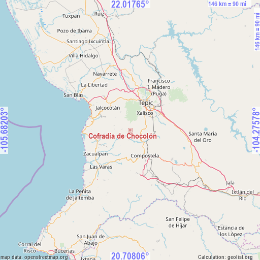
Cofradía de Chocolón GPS coordinates[2]
21° 21' 51.552" North, 104° 58' 44.04" West
| Map corner | latitude | longitude |
|---|---|---|
| Upper-left | 22.01765°, | -105.68203° |
| Center: | 21.36432°, | -104.9789° |
| Lower-right: | 20.70806°, | -104.27578° |
| Map W x H: | 145.6×145.6 km | = 90.5×90.5mi |
| max Lat: | 32.7° ⇑19.4% North |
| Cofradía de Chocolón: | 21.36432° |
| min Lat: | ⇓80.6% South 14.53588° |
| min Long | Cofradía de Ch | max Long |
| -117.105° | -104.9789° | -86.73105° |
| W 8.1%⇐ | ⇒91.9% E |
Elevation
Elevation of Cofradía de Chocolón is 1049 m = 3442 ft, and this is 204.7 m = 672 ft below average elevation for this country.
| Max E: |
3497 m = 11473 ft | 59.1% |
| Avg. | 1253.7 m = 4113 ft | |
| Cofradía de Chocolón | 1049 m = 3442 ft | |
Min E: |
-1 m = -3 ft | 40.9% |
See also: Mexico elevation on elevation.city.
Geographical zone
Cofradía de Chocolón is located in North Torrid zone (between Equator and Tropic of Cancer). Distance of this Northern Tropic circle is 230.4 km =143.2 mi to North.| Distance of | km | miles | from Cofradía de Chocolón |
|---|---|---|---|
| North Pole | 7631.6 | 4742.1 | to North |
| Arctic Circle | 5025.7 | 3122.8 | to North |
| Tropic Cancer | 230.4 | 143.2 | to North |
| Equator | 2375.5 | 1476.1 | to South |


Nearby cities:
15 places around Cofradía de Chocolón: (largest is in red/bold)
• Aquiles Serdán
9.5 km =5.9 mi,  78°
78°
• Compostela
16.3 km =10.1 mi,  149°
149°
• Cuarenteño
11.7 km =7.3 mi,  333°
333°
• El Ahuacate
17.2 km =10.7 mi,  12°
12°
• El Malinal
4.8 km =3 mi,  278°
278°
• El Paranal (Arocha)
14.5 km =9 mi,  226°
226°
• El Verde
18.3 km =11.4 mi,  57°
57°
• Emiliano Zapata
6.8 km =4.2 mi,  89°
89°
• Jalcocotán
18 km =11.2 mi,  316°
316°
• La Curva
14.7 km =9.1 mi, 92°
• Miravalles
13.7 km =8.5 mi,  130°
130°
• Pantanal
14.1 km =8.8 mi, 59°
• Tepic
18.3 km =11.4 mi,  28°
28°
• Testerazo
9.7 km =6 mi, 64°
• Xalisco
12.7 km =7.9 mi,  40°
40°
Sources, notices
• [Note1] Compared only with cities in Mexico existing in our database
• [Src1] Map data: © OpenStreetMap contributors (CC-BY-SA)
• [Src2] Other city data from geonames.org with taken over terms of usage.
• [Src3] Geographical zone / Annual Mean Temperature by Robert A. Rohde @ Wikipedia
