El Verde geodata
El Verde (Nayarit) is a populated place; located in Mexico in America/Mazatlan (GMT-7) time zone. With population of 819 people, there are 10664 cities with bigger population in this country. Compared to other cities in Mexico, 81.2% of cities are located further ↓South; 91.6% of cities are located further →East and 61.2% of cities have higher elevation than El Verde. Note1


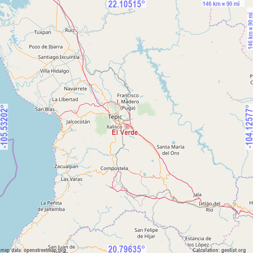
El Verde GPS coordinates[2]
21° 27' 7.992" North, 104° 49' 44.004" West
| Map corner | latitude | longitude |
|---|---|---|
| Upper-left | 22.10515°, | -105.53202° |
| Center: | 21.45222°, | -104.82889° |
| Lower-right: | 20.79635°, | -104.12577° |
| Map W x H: | 145.5×145.5 km | = 90.4×90.4mi |
| max Lat: | 32.7° ⇑18.8% North |
| El Verde: | 21.45222° |
| min Lat: | ⇓81.2% South 14.53588° |
| min Long | El Verde | max Long |
| -117.105° | -104.82889° | -86.73105° |
| W 8.4%⇐ | ⇒91.6% E |
Elevation
Elevation of El Verde is 923 m = 3028 ft, and this is 330.7 m = 1085 ft below average elevation for this country.
| Max E: |
3497 m = 11473 ft | 61.2% |
| Avg. | 1253.7 m = 4113 ft | |
| El Verde | 923 m = 3028 ft | |
Min E: |
-1 m = -3 ft | 38.8% |
See also: Mexico elevation on elevation.city.
Geographical zone
El Verde is located in North Torrid zone (between Equator and Tropic of Cancer). Distance of this Northern Tropic circle is 220.7 km =137.1 mi to North.| Distance of | km | miles | from El Verde |
|---|---|---|---|
| North Pole | 7621.8 | 4736 | to North |
| Arctic Circle | 5015.9 | 3116.7 | to North |
| Tropic Cancer | 220.7 | 137.1 | to North |
| Equator | 2385.3 | 1482.2 | to South |


Nearby cities:
15 places around El Verde: (largest is in red/bold)
• Aquiles Serdán
10 km =6.2 mi,  218°
218°
• Bellavista
13.5 km =8.4 mi,  335°
335°
• Camichín de Jauja
3.3 km =2.1 mi,  63°
63°
• El Refugio
6.9 km =4.3 mi,  125°
125°
• Emiliano Zapata
13 km =8.1 mi, 221°
• La Cantera
5.7 km =3.5 mi,  6°
6°
• La Corregidora
1.9 km =1.2 mi,  117°
117°
• La Curva
10.3 km =6.4 mi,  184°
184°
• Mora
8.5 km =5.3 mi, 13°
• Pantanal
4.3 km =2.7 mi,  231°
231°
• San Cayetano
1.3 km =0.8 mi,  103°
103°
• Tepic
9.4 km =5.8 mi,  312°
312°
• Testerazo
8.7 km =5.4 mi, 230°
• Trigomil
7.6 km =4.7 mi,  149°
149°
• Xalisco
7.2 km =4.5 mi,  268°
268°
Sources, notices
• [Note1] Compared only with cities in Mexico existing in our database
• [Src1] Map data: © OpenStreetMap contributors (CC-BY-SA)
• [Src2] Other city data from geonames.org with taken over terms of usage.
• [Src3] Geographical zone / Annual Mean Temperature by Robert A. Rohde @ Wikipedia
