Indé geodata
Indé (Durango) is a seat of a second-order administrative division; located in Mexico in America/Monterrey (GMT-6) time zone. With population of 659 people, there are 13168 cities with bigger population in this country. Compared to other cities in Mexico, 95% of cities are located further ↓South; 92.4% of cities are located further →East and 66.4% of cities have lower elevation than Indé. Note1


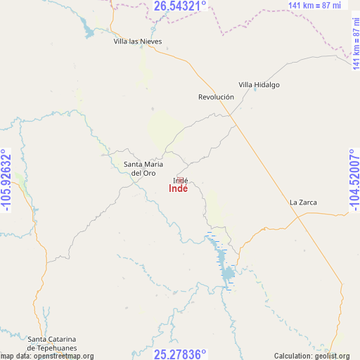
Indé GPS coordinates[2]
25° 54' 44.928" North, 105° 13' 23.484" West
| Map corner | latitude | longitude |
|---|---|---|
| Upper-left | 26.54321°, | -105.92632° |
| Center: | 25.91248°, | -105.22319° |
| Lower-right: | 25.27836°, | -104.52007° |
| Map W x H: | 140.6×140.6 km | = 87.4×87.4mi |
| max Lat: | 32.7° ⇑5% North |
| Indé: | 25.91248° |
| min Lat: | ⇓95% South 14.53588° |
| min Long | Indé | max Long |
| -117.105° | -105.22319° | -86.73105° |
| W 7.6%⇐ | ⇒92.4% E |
Elevation
Elevation of Indé is 1858 m = 6096 ft, and this is 604.3 m = 1983 ft above average elevation for this country.
| Max E: |
3497 m = 11473 ft | 33.6% |
| Indé | 1858 m 6096 ft | |
| Avg. | 1253.7 m = 4113 ft | |
Min E: |
-1 m = -3 ft | 66.4% |
See also: Mexico elevation on elevation.city.
Geographical zone
Indé is located in North temperate zone (between Tropic of Cancer and the Arctic Circle). Distance of this Northern Tropic circle is 275.3 km =171.1 mi to South.| Distance of | km | miles | from Indé |
|---|---|---|---|
| North Pole | 7125.9 | 4427.8 | to North |
| Arctic Circle | 4520 | 2808.6 | to North |
| Tropic Cancer | 275.3 | 171.1 | to South |
| Equator | 2881.2 | 1790.3 | to South |


Nearby cities:
15 places around Indé: (largest is in red/bold)
• Abasolo
87.8 km =54.6 mi,  139°
139°
• Canutillo
54.1 km =33.6 mi,  343°
343°
• Coronado
92.1 km =57.2 mi,  3°
3°
• General Escobedo
44.3 km =27.5 mi,  182°
182°
• Guanaceví
73.4 km =45.6 mi,  271°
271°
• José Esteban Coronado
91.9 km =57.1 mi, 4°
• La Zarca
48.9 km =30.4 mi,  100°
100°
• Los Herrera
88 km =54.7 mi,  198°
198°
• Revolución
35.6 km =22.1 mi,  23°
23°
• San Bernardo
31.7 km =19.7 mi,  288°
288°
• Santa Catarina de Tepehuanes
81.1 km =50.4 mi,  218°
218°
• Santa María del Oro
14.7 km =9.1 mi, 286°
• Torreón de Cañas
51.6 km =32.1 mi,  354°
354°
• Villa Hidalgo
48.4 km =30.1 mi,  39°
39°
• Villa Ocampo
65.2 km =40.5 mi,  334°
334°
Sources, notices
• [Note1] Compared only with cities in Mexico existing in our database
• [Src1] Map data: © OpenStreetMap contributors (CC-BY-SA)
• [Src2] Other city data from geonames.org with taken over terms of usage.
• [Src3] Geographical zone / Annual Mean Temperature by Robert A. Rohde @ Wikipedia
